You are here: Home > Network List > KN - Kyrgyz Seismic Telemetry Network Stations List
> Station CHM KN.CHM > Earthquake Result Viewer
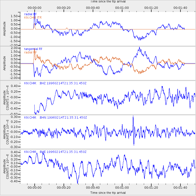
CHM KN.CHM - Earthquake Result Viewer
*The percent match for this event was below the threshold and hence no stack was calculated.
| Earthquake location: |
Southeast Of Honshu, Japan |
| Earthquake latitude/longitude: |
29.2/140.4 |
| Earthquake time(UTC): |
1996/02/14 (045) 21:26:56 GMT |
| Earthquake Depth: |
142 km |
| Earthquake Magnitude: |
5.9 MB |
| Earthquake Catalog/Contributor: |
WHDF/NEIC |
|
| Network: |
KN Kyrgyz Seismic Telemetry Network |
| Station: |
CHM KN.CHM |
| Lat/Lon: |
43.00 N/74.75 E |
| Elevation: |
655 m |
|
| Distance: |
53.5 deg |
| Az: |
303.777 deg |
| Baz: |
82.048 deg |
| Ray Param: |
$rayparam |
*The percent match for this event was below the threshold and hence was not used in the summary stack. |
|
| Radial Match: |
62.177586 % |
| Radial Bump: |
400 |
| Transverse Match: |
58.48029 % |
| Transverse Bump: |
400 |
| SOD ConfigId: |
4480 |
| Insert Time: |
2010-03-08 19:36:58.324 +0000 |
| GWidth: |
2.5 |
| Max Bumps: |
400 |
| Tol: |
0.001 |
|
Signal To Noise
| Channel | StoN | STA | LTA |
| KN:CHM: :BHN:19960214T21:35:31.450Z | 1.0630256 | 3.8805343E-8 | 3.6504616E-8 |
| KN:CHM: :BHE:19960214T21:35:31.450Z | 1.3195143 | 5.3011206E-7 | 4.0174788E-7 |
| KN:CHM: :BHZ:19960214T21:35:31.450Z | 0.7953181 | 1.9908803E-7 | 2.5032503E-7 |
| Arrivals |
| Ps | |
| PpPs | |
| PsPs/PpSs | |


