You are here: Home > Network List > TA - USArray Transportable Network (new EarthScope stations) Stations List
> Station E20K Nigu River, AK, USA > Earthquake Result Viewer
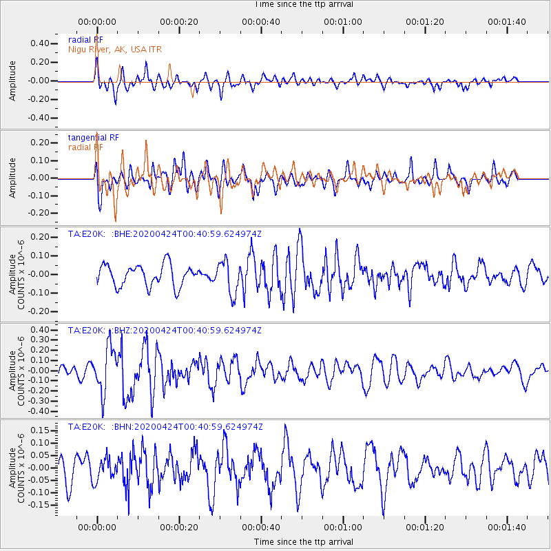
E20K Nigu River, AK, USA - Earthquake Result Viewer
*The percent match for this event was below the threshold and hence no stack was calculated.
| Earthquake location: |
Off Coast Of Chiapas, Mexico |
| Earthquake latitude/longitude: |
13.9/-93.1 |
| Earthquake time(UTC): |
2020/04/24 (115) 00:30:39 GMT |
| Earthquake Depth: |
35 km |
| Earthquake Magnitude: |
5.5 Mww |
| Earthquake Catalog/Contributor: |
NEIC PDE/us |
|
| Network: |
TA USArray Transportable Network (new EarthScope stations) |
| Station: |
E20K Nigu River, AK, USA |
| Lat/Lon: |
68.26 N/156.19 W |
| Elevation: |
866 m |
|
| Distance: |
67.3 deg |
| Az: |
338.894 deg |
| Baz: |
110.204 deg |
| Ray Param: |
$rayparam |
*The percent match for this event was below the threshold and hence was not used in the summary stack. |
|
| Radial Match: |
71.20482 % |
| Radial Bump: |
400 |
| Transverse Match: |
69.66797 % |
| Transverse Bump: |
400 |
| SOD ConfigId: |
21166931 |
| Insert Time: |
2020-05-08 00:43:24.699 +0000 |
| GWidth: |
2.5 |
| Max Bumps: |
400 |
| Tol: |
0.001 |
|
Signal To Noise
| Channel | StoN | STA | LTA |
| TA:E20K: :BHZ:20200424T00:40:59.624974Z | 3.3718872 | 2.2637259E-7 | 6.713528E-8 |
| TA:E20K: :BHN:20200424T00:40:59.624974Z | 1.0171775 | 4.325925E-8 | 4.252871E-8 |
| TA:E20K: :BHE:20200424T00:40:59.624974Z | 1.5995674 | 9.0766754E-8 | 5.674456E-8 |
| Arrivals |
| Ps | |
| PpPs | |
| PsPs/PpSs | |


