You are here: Home > Network List > TA - USArray Transportable Network (new EarthScope stations) Stations List
> Station H16K Elim, AK, USA > Earthquake Result Viewer
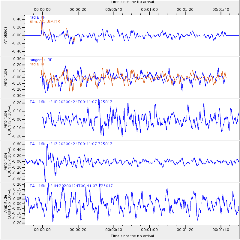
H16K Elim, AK, USA - Earthquake Result Viewer
*The percent match for this event was below the threshold and hence no stack was calculated.
| Earthquake location: |
Off Coast Of Chiapas, Mexico |
| Earthquake latitude/longitude: |
13.9/-93.1 |
| Earthquake time(UTC): |
2020/04/24 (115) 00:30:39 GMT |
| Earthquake Depth: |
35 km |
| Earthquake Magnitude: |
5.5 Mww |
| Earthquake Catalog/Contributor: |
NEIC PDE/us |
|
| Network: |
TA USArray Transportable Network (new EarthScope stations) |
| Station: |
H16K Elim, AK, USA |
| Lat/Lon: |
64.64 N/162.24 W |
| Elevation: |
216 m |
|
| Distance: |
68.6 deg |
| Az: |
334.391 deg |
| Baz: |
102.97 deg |
| Ray Param: |
$rayparam |
*The percent match for this event was below the threshold and hence was not used in the summary stack. |
|
| Radial Match: |
72.92139 % |
| Radial Bump: |
400 |
| Transverse Match: |
72.82057 % |
| Transverse Bump: |
400 |
| SOD ConfigId: |
21166931 |
| Insert Time: |
2020-05-08 00:44:13.238 +0000 |
| GWidth: |
2.5 |
| Max Bumps: |
400 |
| Tol: |
0.001 |
|
Signal To Noise
| Channel | StoN | STA | LTA |
| TA:H16K: :BHZ:20200424T00:41:07.72501Z | 5.101723 | 3.1484623E-7 | 6.17137E-8 |
| TA:H16K: :BHN:20200424T00:41:07.72501Z | 1.4047395 | 9.035896E-8 | 6.4324354E-8 |
| TA:H16K: :BHE:20200424T00:41:07.72501Z | 2.6584492 | 1.1290391E-7 | 4.246984E-8 |
| Arrivals |
| Ps | |
| PpPs | |
| PsPs/PpSs | |


