You are here: Home > Network List > TS - TERRAscope (Southern California Seismic Network) Stations List
> Station SBC Santa Barbara, California, USA > Earthquake Result Viewer
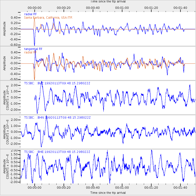
SBC Santa Barbara, California, USA - Earthquake Result Viewer
*The percent match for this event was below the threshold and hence no stack was calculated.
| Earthquake location: |
Fiji Islands Region |
| Earthquake latitude/longitude: |
-20.9/-178.7 |
| Earthquake time(UTC): |
1992/01/13 (013) 09:37:43 GMT |
| Earthquake Depth: |
575 km |
| Earthquake Magnitude: |
5.5 MB |
| Earthquake Catalog/Contributor: |
WHDF/NEIC |
|
| Network: |
TS TERRAscope (Southern California Seismic Network) |
| Station: |
SBC Santa Barbara, California, USA |
| Lat/Lon: |
34.44 N/119.71 W |
| Elevation: |
90 m |
|
| Distance: |
78.6 deg |
| Az: |
46.299 deg |
| Baz: |
234.879 deg |
| Ray Param: |
$rayparam |
*The percent match for this event was below the threshold and hence was not used in the summary stack. |
|
| Radial Match: |
40.58649 % |
| Radial Bump: |
400 |
| Transverse Match: |
59.188786 % |
| Transverse Bump: |
400 |
| SOD ConfigId: |
4480 |
| Insert Time: |
2010-02-26 14:48:46.014 +0000 |
| GWidth: |
2.5 |
| Max Bumps: |
400 |
| Tol: |
0.001 |
|
Signal To Noise
| Channel | StoN | STA | LTA |
| TS:SBC: :BHN:19920113T09:48:15.298022Z | 2.6667645 | 1.1405073E-6 | 4.2767454E-7 |
| TS:SBC: :BHE:19920113T09:48:15.298022Z | 1.2763397 | 1.0320298E-6 | 8.085856E-7 |
| TS:SBC: :BHZ:19920113T09:48:15.298022Z | 0.78738475 | 8.4453194E-7 | 1.0725785E-6 |
| Arrivals |
| Ps | |
| PpPs | |
| PsPs/PpSs | |


