You are here: Home > Network List > TA - USArray Transportable Network (new EarthScope stations) Stations List
> Station F20K Avaraart Lake, AK, USA > Earthquake Result Viewer
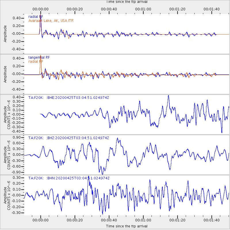
F20K Avaraart Lake, AK, USA - Earthquake Result Viewer

| Earthquake location: |
Solomon Islands |
| Earthquake latitude/longitude: |
-6.5/154.3 |
| Earthquake time(UTC): |
2020/04/25 (116) 02:53:05 GMT |
| Earthquake Depth: |
17 km |
| Earthquake Magnitude: |
6.3 mww |
| Earthquake Catalog/Contributor: |
NEIC PDE/us |
|
| Network: |
TA USArray Transportable Network (new EarthScope stations) |
| Station: |
F20K Avaraart Lake, AK, USA |
| Lat/Lon: |
67.05 N/155.73 W |
| Elevation: |
136 m |
|
| Distance: |
81.5 deg |
| Az: |
17.674 deg |
| Baz: |
230.285 deg |
| Ray Param: |
0.047504354 |
| Estimated Moho Depth: |
29.75 km |
| Estimated Crust Vp/Vs: |
1.60 |
| Assumed Crust Vp: |
6.522 km/s |
| Estimated Crust Vs: |
4.07 km/s |
| Estimated Crust Poisson's Ratio: |
0.18 |
|
| Radial Match: |
90.85247 % |
| Radial Bump: |
400 |
| Transverse Match: |
73.4527 % |
| Transverse Bump: |
400 |
| SOD ConfigId: |
21166931 |
| Insert Time: |
2020-05-09 03:03:13.571 +0000 |
| GWidth: |
2.5 |
| Max Bumps: |
400 |
| Tol: |
0.001 |
|
Signal To Noise
| Channel | StoN | STA | LTA |
| TA:F20K: :BHZ:20200425T03:04:51.024974Z | 3.945095 | 2.1877746E-7 | 5.5455562E-8 |
| TA:F20K: :BHN:20200425T03:04:51.024974Z | 0.92020386 | 3.6439705E-8 | 3.9599602E-8 |
| TA:F20K: :BHE:20200425T03:04:51.024974Z | 1.968709 | 6.4384956E-8 | 3.270415E-8 |
| Arrivals |
| Ps | 2.8 SECOND |
| PpPs | 12 SECOND |
| PsPs/PpSs | 14 SECOND |


