
EKS2 KN.EKS2 - Earthquake Result Viewer
| ||||||||||||||||||
| ||||||||||||||||||
| ||||||||||||||||||
|
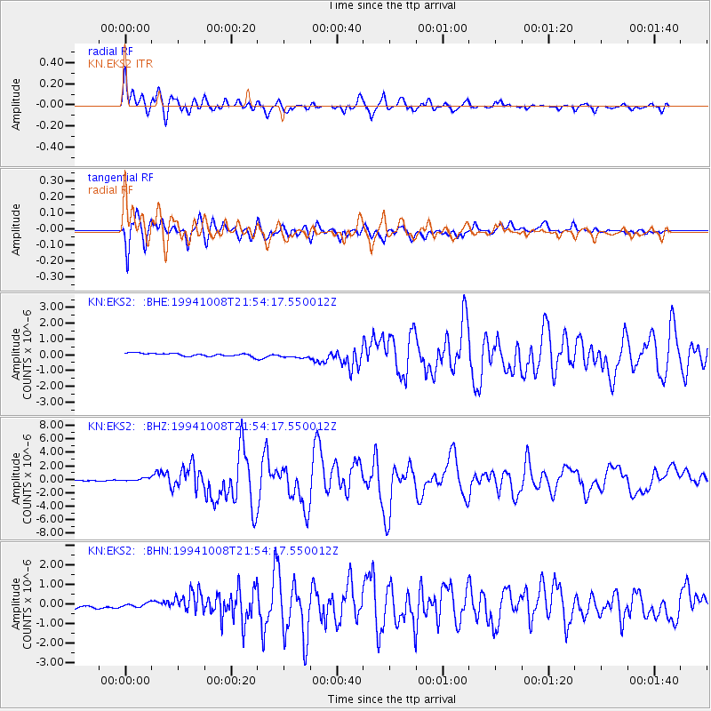
Signal To Noise
| Channel | StoN | STA | LTA |
| KN:EKS2: :BHZ:19941008T21:54:17.550012Z | 2.0173903 | 2.3125799E-7 | 1.1463225E-7 |
| KN:EKS2: :BHN:19941008T21:54:17.550012Z | 0.5821882 | 9.760535E-8 | 1.6765257E-7 |
| KN:EKS2: :BHE:19941008T21:54:17.550012Z | 1.8225243 | 1.728735E-7 | 9.4853874E-8 |
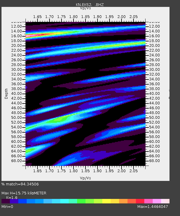
| Arrivals | |
| Ps | 1.6 SECOND |
| PpPs | 6.2 SECOND |
| PsPs/PpSs | 7.8 SECOND |

