EKS2 KN.EKS2 - Earthquake Result Viewer
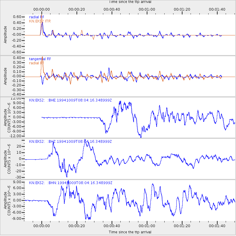
Earthquake location: Kuril Islands
Earthquake latitude/longitude: 43.9/147.9
Earthquake time(UTC): 1994/10/09 (282) 07:55:38 GMT
Earthquake Depth: 23 km
Earthquake Magnitude: 6.5 MB, 7.0 MS, 6.7 UNKNOWN, 7.3 MW
Earthquake Catalog/Contributor: WHDF/NEIC
Network: KN Kyrgyz Seismic Telemetry Network
Station: EKS2 KN.EKS2
Lat/Lon: 42.66 N/73.78 E
Elevation: 1360 m
Distance: 52.2 deg
Az: 296.172 deg
Baz: 61.585 deg
Ray Param: 0.06685433
Estimated Moho Depth: 42.75 km
Estimated Crust Vp/Vs: 1.87
Assumed Crust Vp: 6.316 km/s
Estimated Crust Vs: 3.373 km/s
Estimated Crust Poisson's Ratio: 0.30
Radial Match: 96.1439 %
Radial Bump: 368
Transverse Match: 89.6028 %
Transverse Bump: 400
SOD ConfigId: 4480
Insert Time: 2010-03-08 19:37:45.191 +0000
GWidth: 2.5
Max Bumps: 400
Tol: 0.001

Signal To Noise

ChannelStoNSTALTA
KN:EKS2: :BHZ:19941009T08:04:16.348999Z22.9013062.9555597E-61.2905639E-7
KN:EKS2: :BHN:19941009T08:04:16.348999Z5.19107067.722822E-71.4877128E-7
KN:EKS2: :BHE:19941009T08:04:16.348999Z7.62508069.615859E-71.2610829E-7
Arrivals
Ps6.2 SECOND
PpPs18 SECOND
PsPs/PpSs25 SECOND