You are here: Home > Network List > TS - TERRAscope (Southern California Seismic Network) Stations List
> Station SBC Santa Barbara, California, USA > Earthquake Result Viewer
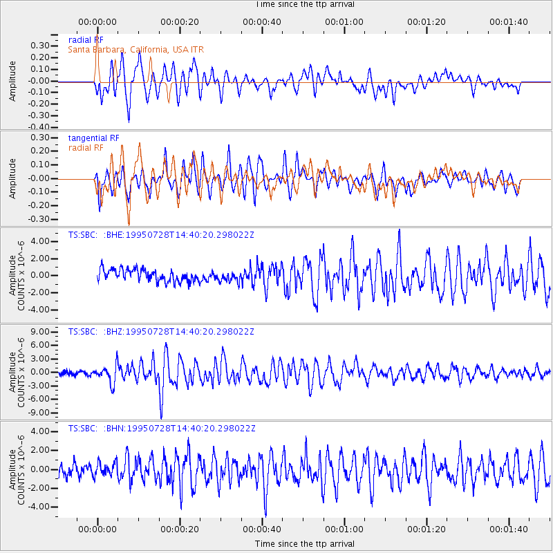
SBC Santa Barbara, California, USA - Earthquake Result Viewer
*The percent match for this event was below the threshold and hence no stack was calculated.
| Earthquake location: |
Tonga Islands |
| Earthquake latitude/longitude: |
-21.1/-175.5 |
| Earthquake time(UTC): |
1995/07/28 (209) 14:29:12 GMT |
| Earthquake Depth: |
102 km |
| Earthquake Magnitude: |
6.1 MB, 6.5 UNKNOWN, 6.4 MW |
| Earthquake Catalog/Contributor: |
WHDF/NEIC |
|
| Network: |
TS TERRAscope (Southern California Seismic Network) |
| Station: |
SBC Santa Barbara, California, USA |
| Lat/Lon: |
34.44 N/119.71 W |
| Elevation: |
90 m |
|
| Distance: |
76.5 deg |
| Az: |
44.636 deg |
| Baz: |
232.545 deg |
| Ray Param: |
$rayparam |
*The percent match for this event was below the threshold and hence was not used in the summary stack. |
|
| Radial Match: |
83.31482 % |
| Radial Bump: |
400 |
| Transverse Match: |
77.97638 % |
| Transverse Bump: |
400 |
| SOD ConfigId: |
4480 |
| Insert Time: |
2010-02-26 14:48:48.738 +0000 |
| GWidth: |
2.5 |
| Max Bumps: |
400 |
| Tol: |
0.001 |
|
Signal To Noise
| Channel | StoN | STA | LTA |
| TS:SBC: :BHZ:19950728T14:40:20.298022Z | 5.4980845 | 2.0558186E-6 | 3.739154E-7 |
| TS:SBC: :BHN:19950728T14:40:20.298022Z | 0.98634857 | 7.6313944E-7 | 7.737016E-7 |
| TS:SBC: :BHE:19950728T14:40:20.298022Z | 0.8392214 | 5.815405E-7 | 6.929524E-7 |
| Arrivals |
| Ps | |
| PpPs | |
| PsPs/PpSs | |


