EKS2 KN.EKS2 - Earthquake Result Viewer
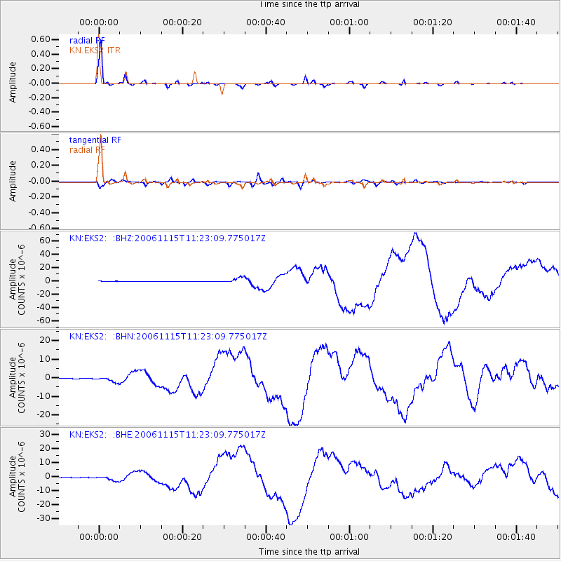
Earthquake location: Kuril Islands
Earthquake latitude/longitude: 46.6/153.3
Earthquake time(UTC): 2006/11/15 (319) 11:14:13 GMT
Earthquake Depth: 10 km
Earthquake Magnitude: 6.5 MB, 7.8 MS, 8.3 MW, 7.9 MW
Earthquake Catalog/Contributor: WHDF/NEIC
Network: KN Kyrgyz Seismic Telemetry Network
Station: EKS2 KN.EKS2
Lat/Lon: 42.66 N/73.78 E
Elevation: 1360 m
Distance: 54.4 deg
Az: 296.915 deg
Baz: 56.474 deg
Ray Param: 0.065455675
Estimated Moho Depth: 60.25 km
Estimated Crust Vp/Vs: 1.62
Assumed Crust Vp: 6.316 km/s
Estimated Crust Vs: 3.892 km/s
Estimated Crust Poisson's Ratio: 0.19
Radial Match: 98.09018 %
Radial Bump: 245
Transverse Match: 84.10981 %
Transverse Bump: 400
SOD ConfigId: 2564
Insert Time: 2010-03-08 19:38:52.037 +0000
GWidth: 2.5
Max Bumps: 400
Tol: 0.001

Signal To Noise

ChannelStoNSTALTA
KN:EKS2: :BHN:20061115T11:23:09.775017Z6.7202671.3317989E-61.981765E-7
KN:EKS2: :BHE:20061115T11:23:09.775017Z4.47998331.5234749E-63.4006263E-7
KN:EKS2: :BHZ:20061115T11:23:09.775017Z13.3669724.1119442E-63.076197E-7
Arrivals
Ps6.3 SECOND
PpPs24 SECOND
PsPs/PpSs30 SECOND