You are here: Home > Network List > TA - USArray Transportable Network (new EarthScope stations) Stations List
> Station C16K Lisburne Hills, AK, USA > Earthquake Result Viewer
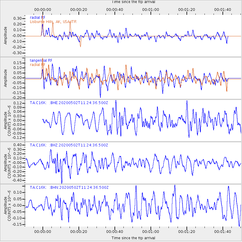
C16K Lisburne Hills, AK, USA - Earthquake Result Viewer
*The percent match for this event was below the threshold and hence no stack was calculated.
| Earthquake location: |
Puerto Rico Region |
| Earthquake latitude/longitude: |
17.9/-66.7 |
| Earthquake time(UTC): |
2020/05/02 (123) 11:13:17 GMT |
| Earthquake Depth: |
10 km |
| Earthquake Magnitude: |
5.5 Mi |
| Earthquake Catalog/Contributor: |
NEIC PDE/pt |
|
| Network: |
TA USArray Transportable Network (new EarthScope stations) |
| Station: |
C16K Lisburne Hills, AK, USA |
| Lat/Lon: |
68.27 N/165.34 W |
| Elevation: |
102 m |
|
| Distance: |
76.6 deg |
| Az: |
337.768 deg |
| Baz: |
75.34 deg |
| Ray Param: |
$rayparam |
*The percent match for this event was below the threshold and hence was not used in the summary stack. |
|
| Radial Match: |
50.948967 % |
| Radial Bump: |
400 |
| Transverse Match: |
68.81107 % |
| Transverse Bump: |
400 |
| SOD ConfigId: |
21166931 |
| Insert Time: |
2020-05-16 11:26:50.636 +0000 |
| GWidth: |
2.5 |
| Max Bumps: |
400 |
| Tol: |
0.001 |
|
Signal To Noise
| Channel | StoN | STA | LTA |
| TA:C16K: :BHZ:20200502T11:24:36.500Z | 2.2075624 | 1.2860306E-7 | 5.8255686E-8 |
| TA:C16K: :BHN:20200502T11:24:36.500Z | 0.7703194 | 3.4398028E-8 | 4.4654243E-8 |
| TA:C16K: :BHE:20200502T11:24:36.500Z | 1.3138082 | 5.384443E-8 | 4.098348E-8 |
| Arrivals |
| Ps | |
| PpPs | |
| PsPs/PpSs | |


