You are here: Home > Network List > TA - USArray Transportable Network (new EarthScope stations) Stations List
> Station H31M Peel River, Yukon, CAN > Earthquake Result Viewer
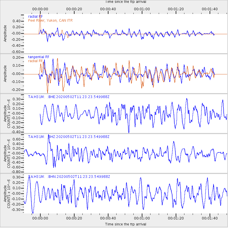
H31M Peel River, Yukon, CAN - Earthquake Result Viewer
*The percent match for this event was below the threshold and hence no stack was calculated.
| Earthquake location: |
Puerto Rico Region |
| Earthquake latitude/longitude: |
17.9/-66.7 |
| Earthquake time(UTC): |
2020/05/02 (123) 11:13:17 GMT |
| Earthquake Depth: |
10 km |
| Earthquake Magnitude: |
5.5 Mi |
| Earthquake Catalog/Contributor: |
NEIC PDE/pt |
|
| Network: |
TA USArray Transportable Network (new EarthScope stations) |
| Station: |
H31M Peel River, Yukon, CAN |
| Lat/Lon: |
65.81 N/134.34 W |
| Elevation: |
642 m |
|
| Distance: |
64.6 deg |
| Az: |
335.057 deg |
| Baz: |
103.064 deg |
| Ray Param: |
$rayparam |
*The percent match for this event was below the threshold and hence was not used in the summary stack. |
|
| Radial Match: |
55.725616 % |
| Radial Bump: |
400 |
| Transverse Match: |
54.770947 % |
| Transverse Bump: |
400 |
| SOD ConfigId: |
21166931 |
| Insert Time: |
2020-05-16 11:27:52.501 +0000 |
| GWidth: |
2.5 |
| Max Bumps: |
400 |
| Tol: |
0.001 |
|
Signal To Noise
| Channel | StoN | STA | LTA |
| TA:H31M: :BHZ:20200502T11:23:23.549988Z | 3.1797802 | 2.6018006E-7 | 8.182328E-8 |
| TA:H31M: :BHN:20200502T11:23:23.549988Z | 0.71008044 | 9.936686E-8 | 1.3993747E-7 |
| TA:H31M: :BHE:20200502T11:23:23.549988Z | 0.8671635 | 9.856817E-8 | 1.1366735E-7 |
| Arrivals |
| Ps | |
| PpPs | |
| PsPs/PpSs | |


