You are here: Home > Network List > TS - TERRAscope (Southern California Seismic Network) Stations List
> Station SBC Santa Barbara, California, USA > Earthquake Result Viewer
SBC Santa Barbara, California, USA - Earthquake Result Viewer
*The percent match for this event was below the threshold and hence no stack was calculated.
| Earthquake location: |
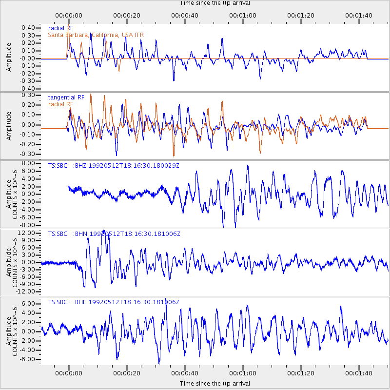
Samoa Islands Region |
| Earthquake latitude/longitude: |
-16.5/-172.4 |
| Earthquake time(UTC): |
1992/05/12 (133) 18:05:45 GMT |
| Earthquake Depth: |
33 km |
| Earthquake Magnitude: |
6.3 MB, 6.8 MS |
| Earthquake Catalog/Contributor: |
WHDF/NEIC |
|
| Network: |
TS TERRAscope (Southern California Seismic Network) |
| Station: |
SBC Santa Barbara, California, USA |
| Lat/Lon: |
34.44 N/119.71 W |
| Elevation: |
90 m |
|
| Distance: |
71.2 deg |
| Az: |
43.985 deg |
| Baz: |
233.737 deg |
| Ray Param: |
$rayparam |
*The percent match for this event was below the threshold and hence was not used in the summary stack. |
|
| Radial Match: |
84.991066 % |
| Radial Bump: |
400 |
| Transverse Match: |
81.235214 % |
| Transverse Bump: |
400 |
| SOD ConfigId: |
4480 |
| Insert Time: |
2010-02-26 14:48:53.953 +0000 |
| GWidth: |
2.5 |
| Max Bumps: |
400 |
| Tol: |
0.001 |
|
Signal To Noise
| Channel | StoN | STA | LTA |
| TS:SBC: :BHN:19920512T18:16:30.181006Z | 4.4474416 | 1.6759602E-6 | 3.7683694E-7 |
| TS:SBC: :BHE:19920512T18:16:30.181006Z | 0.98152524 | 8.451775E-7 | 8.610858E-7 |
| TS:SBC: :BHZ:19920512T18:16:30.180029Z | 1.2283312 | 9.855243E-7 | 8.0232786E-7 |
| Arrivals |
| Ps | |
| PpPs | |
| PsPs/PpSs | |


