You are here: Home > Network List > US - United States National Seismic Network Stations List
> Station LAO LASA Array, Montana, USA > Earthquake Result Viewer
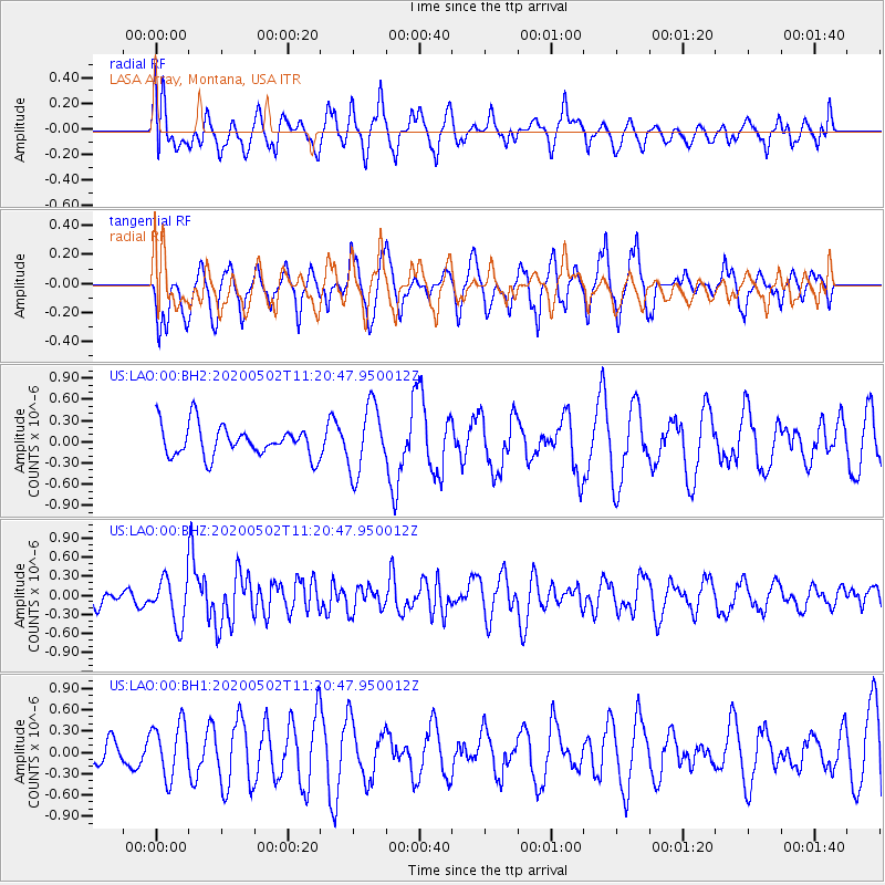
LAO LASA Array, Montana, USA - Earthquake Result Viewer
*The percent match for this event was below the threshold and hence no stack was calculated.
| Earthquake location: |
Puerto Rico Region |
| Earthquake latitude/longitude: |
17.9/-66.7 |
| Earthquake time(UTC): |
2020/05/02 (123) 11:13:17 GMT |
| Earthquake Depth: |
10 km |
| Earthquake Magnitude: |
5.5 Mi |
| Earthquake Catalog/Contributor: |
NEIC PDE/pt |
|
| Network: |
US United States National Seismic Network |
| Station: |
LAO LASA Array, Montana, USA |
| Lat/Lon: |
46.69 N/106.22 W |
| Elevation: |
902 m |
|
| Distance: |
43.3 deg |
| Az: |
320.331 deg |
| Baz: |
118.02 deg |
| Ray Param: |
$rayparam |
*The percent match for this event was below the threshold and hence was not used in the summary stack. |
|
| Radial Match: |
46.744053 % |
| Radial Bump: |
400 |
| Transverse Match: |
67.59334 % |
| Transverse Bump: |
376 |
| SOD ConfigId: |
21166931 |
| Insert Time: |
2020-05-16 11:29:58.442 +0000 |
| GWidth: |
2.5 |
| Max Bumps: |
400 |
| Tol: |
0.001 |
|
Signal To Noise
| Channel | StoN | STA | LTA |
| US:LAO:00:BHZ:20200502T11:20:47.950012Z | 2.672787 | 3.5582968E-7 | 1.3313058E-7 |
| US:LAO:00:BH1:20200502T11:20:47.950012Z | 1.4384617 | 3.8032704E-7 | 2.6439847E-7 |
| US:LAO:00:BH2:20200502T11:20:47.950012Z | 2.1780229 | 4.7505725E-7 | 2.18114E-7 |
| Arrivals |
| Ps | |
| PpPs | |
| PsPs/PpSs | |


