You are here: Home > Network List > US - United States National Seismic Network Stations List
> Station HAWA Hanford, Washington, USA > Earthquake Result Viewer
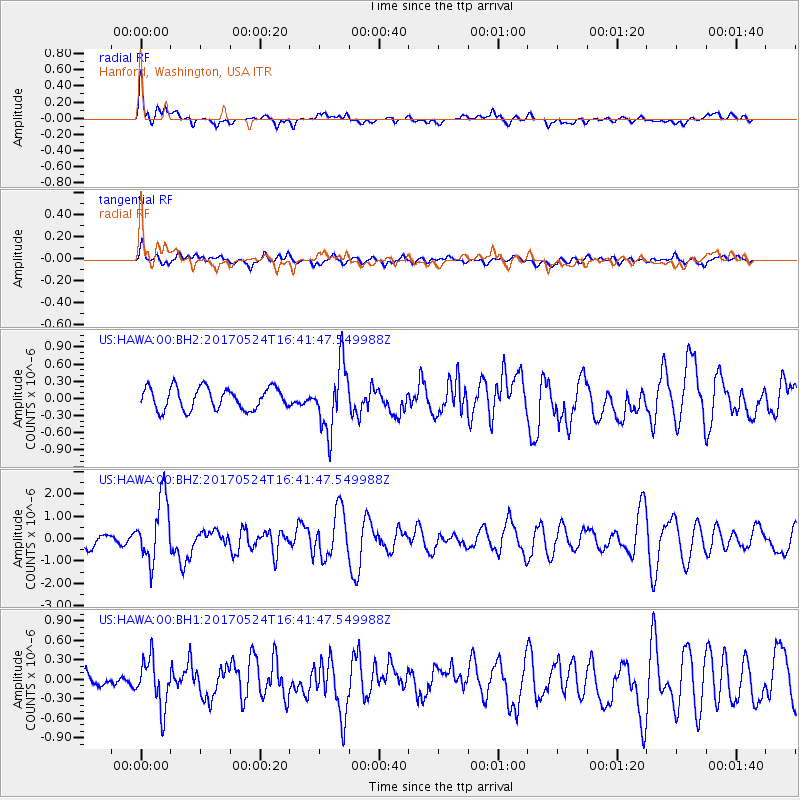
HAWA Hanford, Washington, USA - Earthquake Result Viewer
*The percent match for this event was below the threshold and hence no stack was calculated.
| Earthquake location: |
Fox Islands, Aleutian Islands |
| Earthquake latitude/longitude: |
52.4/-166.7 |
| Earthquake time(UTC): |
2017/05/24 (144) 16:36:01 GMT |
| Earthquake Depth: |
2.0 km |
| Earthquake Magnitude: |
5.7 Mi |
| Earthquake Catalog/Contributor: |
NEIC PDE/at |
|
| Network: |
US United States National Seismic Network |
| Station: |
HAWA Hanford, Washington, USA |
| Lat/Lon: |
46.39 N/119.53 W |
| Elevation: |
364 m |
|
| Distance: |
30.8 deg |
| Az: |
82.136 deg |
| Baz: |
298.771 deg |
| Ray Param: |
$rayparam |
*The percent match for this event was below the threshold and hence was not used in the summary stack. |
|
| Radial Match: |
75.395485 % |
| Radial Bump: |
400 |
| Transverse Match: |
58.645645 % |
| Transverse Bump: |
400 |
| SOD ConfigId: |
2028011 |
| Insert Time: |
2017-06-07 16:43:28.609 +0000 |
| GWidth: |
2.5 |
| Max Bumps: |
400 |
| Tol: |
0.001 |
|
Signal To Noise
| Channel | StoN | STA | LTA |
| US:HAWA:00:BHZ:20170524T16:41:47.549988Z | 6.0333157 | 1.4079934E-6 | 2.3336975E-7 |
| US:HAWA:00:BH1:20170524T16:41:47.549988Z | 2.04304 | 3.7126264E-7 | 1.8172068E-7 |
| US:HAWA:00:BH2:20170524T16:41:47.549988Z | 2.968951 | 5.6676623E-7 | 1.9089781E-7 |
| Arrivals |
| Ps | |
| PpPs | |
| PsPs/PpSs | |


