
EKS2 KN.EKS2 - Earthquake Result Viewer
| ||||||||||||||||||
| ||||||||||||||||||
| ||||||||||||||||||
|
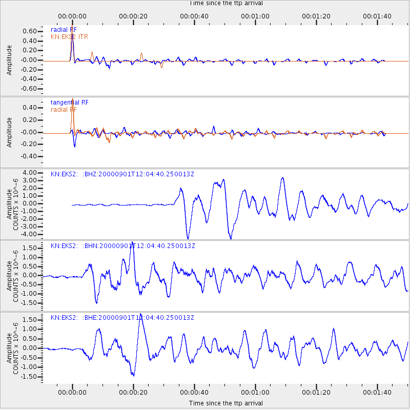
Signal To Noise
| Channel | StoN | STA | LTA |
| KN:EKS2: :BHN:20000901T12:04:40.250013Z | 2.8415575 | 1.1723249E-7 | 4.125642E-8 |
| KN:EKS2: :BHE:20000901T12:04:40.250013Z | 4.6917577 | 1.3422401E-7 | 2.860847E-8 |
| KN:EKS2: :BHZ:20000901T12:04:40.250013Z | 6.7914853 | 3.5943495E-7 | 5.2924353E-8 |
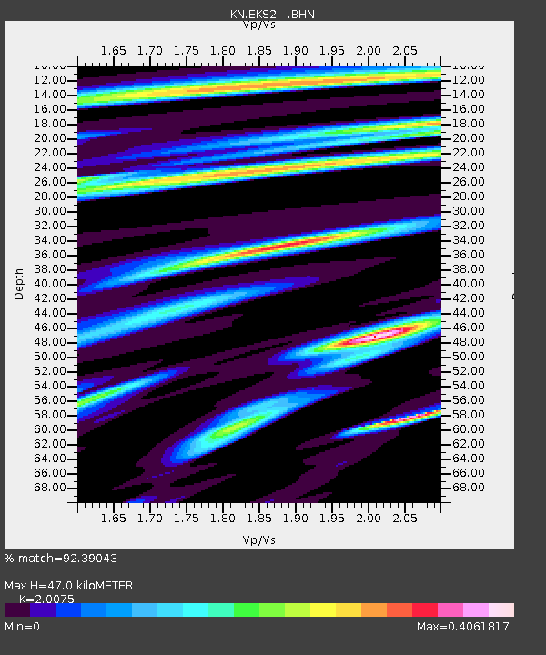
| Arrivals | |
| Ps | 7.9 SECOND |
| PpPs | 21 SECOND |
| PsPs/PpSs | 29 SECOND |

