EKS2 KN.EKS2 - Earthquake Result Viewer
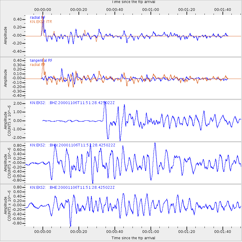
Earthquake location: Kodiak Island Region, Alaska
Earthquake latitude/longitude: 56.2/-153.5
Earthquake time(UTC): 2000/11/06 (311) 11:40:26 GMT
Earthquake Depth: 20 km
Earthquake Magnitude: 5.5 MB, 5.6 MS, 6.0 MW, 5.5 ML
Earthquake Catalog/Contributor: WHDF/NEIC
Network: KN Kyrgyz Seismic Telemetry Network
Station: EKS2 KN.EKS2
Lat/Lon: 42.66 N/73.78 E
Elevation: 1360 m
Distance: 73.8 deg
Az: 325.67 deg
Baz: 25.331 deg
Ray Param: 0.05275513
Estimated Moho Depth: 16.25 km
Estimated Crust Vp/Vs: 1.60
Assumed Crust Vp: 6.316 km/s
Estimated Crust Vs: 3.947 km/s
Estimated Crust Poisson's Ratio: 0.18
Radial Match: 92.865425 %
Radial Bump: 400
Transverse Match: 84.41228 %
Transverse Bump: 400
SOD ConfigId: 3744
Insert Time: 2010-03-08 19:41:23.971 +0000
GWidth: 2.5
Max Bumps: 400
Tol: 0.001

Signal To Noise

ChannelStoNSTALTA
KN:EKS2: :BHN:20001106T11:51:28.425022Z2.83150082.0111716E-77.102847E-8
KN:EKS2: :BHE:20001106T11:51:28.425022Z1.64993561.3964002E-78.463362E-8
KN:EKS2: :BHZ:20001106T11:51:28.425022Z15.6495927.88913E-75.0411085E-8
Arrivals
Ps1.6 SECOND
PpPs6.5 SECOND
PsPs/PpSs8.1 SECOND