EKS2 KN.EKS2 - Earthquake Result Viewer
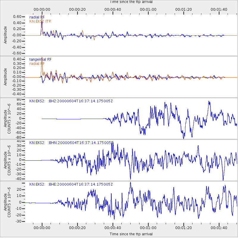
Earthquake location: Southern Sumatra, Indonesia
Earthquake latitude/longitude: -4.7/102.1
Earthquake time(UTC): 2000/06/04 (156) 16:28:26 GMT
Earthquake Depth: 33 km
Earthquake Magnitude: 6.8 MB, 8.0 MS, 7.9 MW, 7.7 MW
Earthquake Catalog/Contributor: WHDF/NEIC
Network: KN Kyrgyz Seismic Telemetry Network
Station: EKS2 KN.EKS2
Lat/Lon: 42.66 N/73.78 E
Elevation: 1360 m
Distance: 53.7 deg
Az: 334.275 deg
Baz: 144.092 deg
Ray Param: 0.065862775
Estimated Moho Depth: 49.0 km
Estimated Crust Vp/Vs: 1.99
Assumed Crust Vp: 6.316 km/s
Estimated Crust Vs: 3.17 km/s
Estimated Crust Poisson's Ratio: 0.33
Radial Match: 93.3169 %
Radial Bump: 400
Transverse Match: 84.734406 %
Transverse Bump: 400
SOD ConfigId: 3744
Insert Time: 2010-03-08 19:41:43.779 +0000
GWidth: 2.5
Max Bumps: 400
Tol: 0.001

Signal To Noise

ChannelStoNSTALTA
KN:EKS2: :BHN:20000604T16:37:14.175005Z1.93641513.5902875E-71.8540898E-7
KN:EKS2: :BHE:20000604T16:37:14.175005Z3.50326942.8588866E-78.1606245E-8
KN:EKS2: :BHZ:20000604T16:37:14.175005Z4.4564737.908603E-71.7746328E-7
Arrivals
Ps8.1 SECOND
PpPs22 SECOND
PsPs/PpSs30 SECOND