EKS2 KN.EKS2 - Earthquake Result Viewer
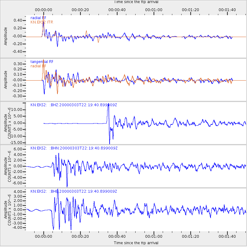
Earthquake location: Banda Sea
Earthquake latitude/longitude: -7.3/128.5
Earthquake time(UTC): 2000/03/03 (063) 22:09:13 GMT
Earthquake Depth: 142 km
Earthquake Magnitude: 6.4 MB, 5.8 MS, 6.3 MW, 6.3 MW
Earthquake Catalog/Contributor: WHDF/NEIC
Network: KN Kyrgyz Seismic Telemetry Network
Station: EKS2 KN.EKS2
Lat/Lon: 42.66 N/73.78 E
Elevation: 1360 m
Distance: 70.3 deg
Az: 320.24 deg
Baz: 120.674 deg
Ray Param: 0.054701608
Estimated Moho Depth: 15.5 km
Estimated Crust Vp/Vs: 1.61
Assumed Crust Vp: 6.316 km/s
Estimated Crust Vs: 3.935 km/s
Estimated Crust Poisson's Ratio: 0.18
Radial Match: 92.85044 %
Radial Bump: 400
Transverse Match: 91.2338 %
Transverse Bump: 400
SOD ConfigId: 3744
Insert Time: 2010-03-08 19:41:51.080 +0000
GWidth: 2.5
Max Bumps: 400
Tol: 0.001

Signal To Noise

ChannelStoNSTALTA
KN:EKS2: :BHN:20000303T22:19:40.899009Z2.16827253.0359212E-71.4001566E-7
KN:EKS2: :BHE:20000303T22:19:40.899009Z4.30005465.385473E-71.2524195E-7
KN:EKS2: :BHZ:20000303T22:19:40.899009Z21.420652.1863705E-61.0206835E-7
Arrivals
Ps1.5 SECOND
PpPs6.1 SECOND
PsPs/PpSs7.7 SECOND