
EKS2 KN.EKS2 - Earthquake Result Viewer
| ||||||||||||||||||
| ||||||||||||||||||
| ||||||||||||||||||
|
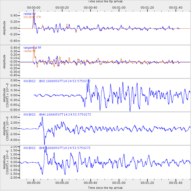
Signal To Noise
| Channel | StoN | STA | LTA |
| KN:EKS2: :BHN:19990507T14:24:53.575027Z | 12.295081 | 7.1175543E-7 | 5.7889444E-8 |
| KN:EKS2: :BHE:19990507T14:24:53.575027Z | 4.545602 | 2.2647667E-7 | 4.9823253E-8 |
| KN:EKS2: :BHZ:19990507T14:24:53.575027Z | 3.021696 | 1.15485186E-7 | 3.8218666E-8 |
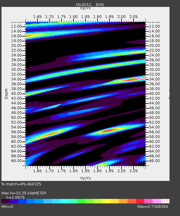
| Arrivals | |
| Ps | 5.9 SECOND |
| PpPs | 16 SECOND |
| PsPs/PpSs | 22 SECOND |

