
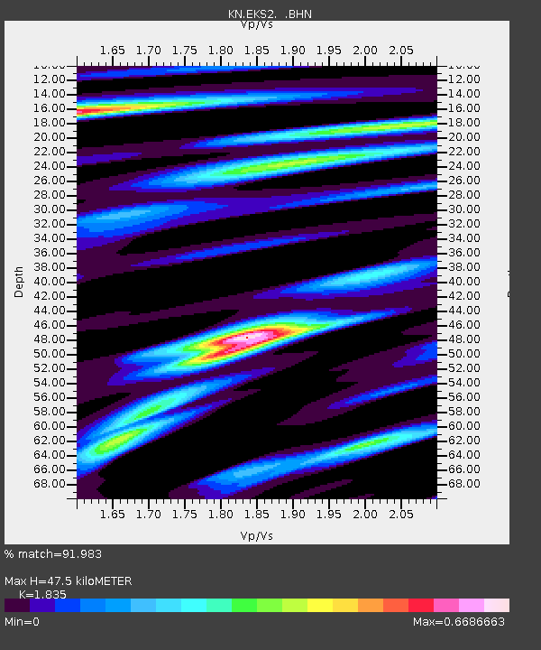
EKS2 KN.EKS2 - Earthquake Result Viewer
| ||||||||||||||||||
| ||||||||||||||||||
| ||||||||||||||||||
|
Signal To Noise
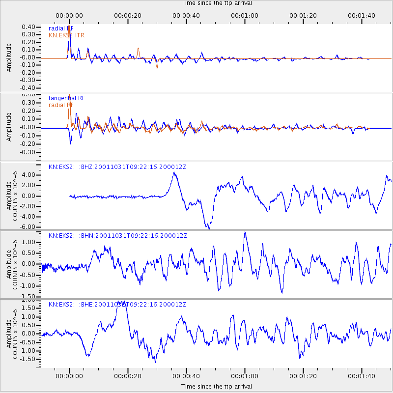
| Channel | StoN | STA | LTA |
| KN:EKS2: :BHN:20011031T09:22:16.200012Z | 0.45130175 | 6.6862555E-8 | 1.4815487E-7 |
| KN:EKS2: :BHE:20011031T09:22:16.200012Z | 1.5859938 | 2.3079618E-7 | 1.4552148E-7 |
| KN:EKS2: :BHZ:20011031T09:22:16.200012Z | 7.336507 | 8.6469316E-7 | 1.17861696E-7 |
| Arrivals | |
| Ps | 6.4 SECOND |
| PpPs | 21 SECOND |
| PsPs/PpSs | 27 SECOND |

