
EKS2 KN.EKS2 - Earthquake Result Viewer
| ||||||||||||||||||
| ||||||||||||||||||
| ||||||||||||||||||
|
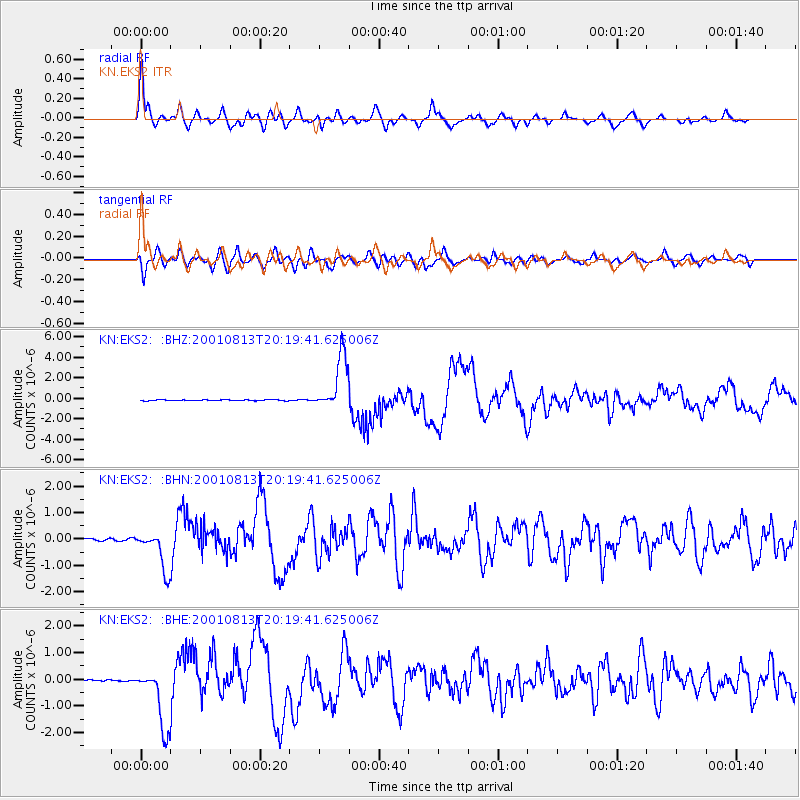
Signal To Noise
| Channel | StoN | STA | LTA |
| KN:EKS2: :BHN:20010813T20:19:41.625006Z | 20.201189 | 7.54967E-7 | 3.7372406E-8 |
| KN:EKS2: :BHE:20010813T20:19:41.625006Z | 40.54134 | 1.1674043E-6 | 2.8795405E-8 |
| KN:EKS2: :BHZ:20010813T20:19:41.625006Z | 62.018467 | 2.6775078E-6 | 4.3172754E-8 |
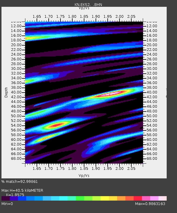
| Arrivals | |
| Ps | 6.5 SECOND |
| PpPs | 18 SECOND |
| PsPs/PpSs | 24 SECOND |

