
EKS2 KN.EKS2 - Earthquake Result Viewer
| ||||||||||||||||||
| ||||||||||||||||||
| ||||||||||||||||||
|
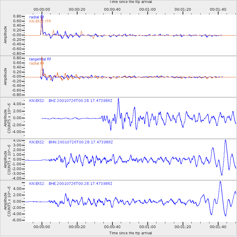
Signal To Noise
| Channel | StoN | STA | LTA |
| KN:EKS2: :BHN:20010726T00:28:17.473986Z | 1.1222638 | 8.549009E-8 | 7.617646E-8 |
| KN:EKS2: :BHE:20010726T00:28:17.473986Z | 4.05299 | 1.1084473E-7 | 2.7348879E-8 |
| KN:EKS2: :BHZ:20010726T00:28:17.473986Z | 2.813423 | 2.645104E-7 | 9.4017295E-8 |
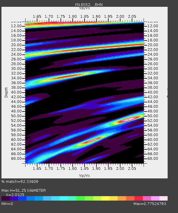
| Arrivals | |
| Ps | 8.9 SECOND |
| PpPs | 23 SECOND |
| PsPs/PpSs | 32 SECOND |

