
EKS2 KN.EKS2 - Earthquake Result Viewer
| ||||||||||||||||||
| ||||||||||||||||||
| ||||||||||||||||||
|
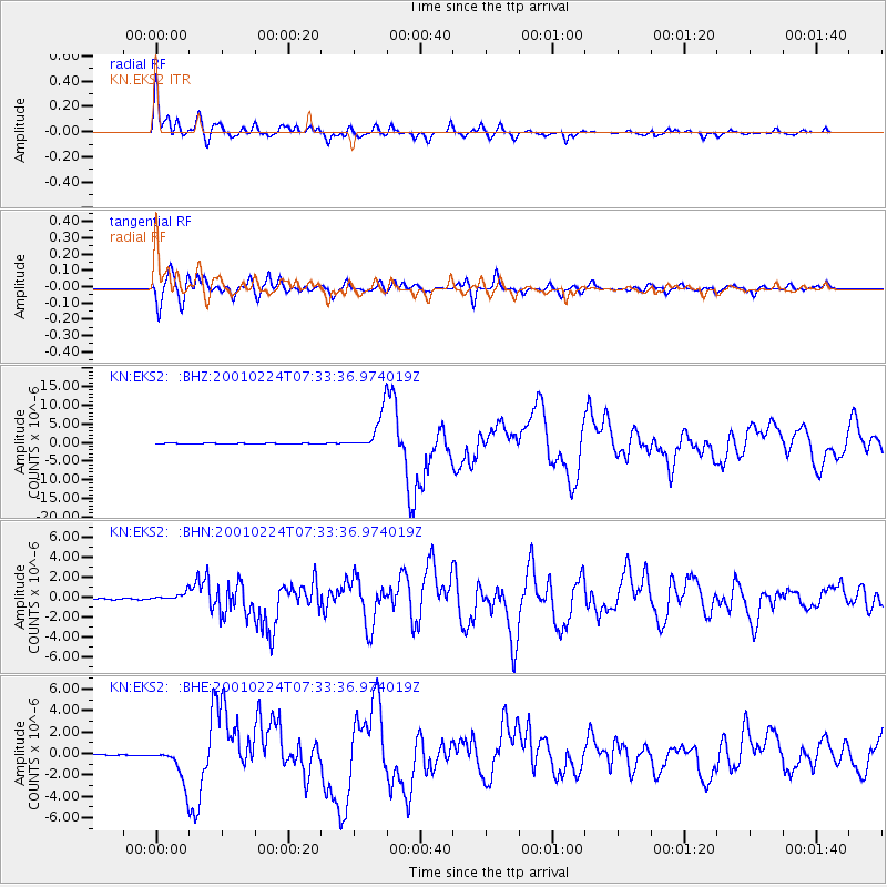
Signal To Noise
| Channel | StoN | STA | LTA |
| KN:EKS2: :BHN:20010224T07:33:36.974019Z | 7.6485972 | 4.231351E-7 | 5.5321923E-8 |
| KN:EKS2: :BHE:20010224T07:33:36.974019Z | 18.156021 | 1.6768732E-6 | 9.235908E-8 |
| KN:EKS2: :BHZ:20010224T07:33:36.974019Z | 45.923386 | 5.0898143E-6 | 1.1083273E-7 |
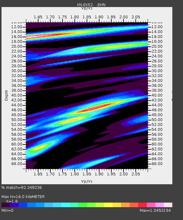
| Arrivals | |
| Ps | 1.6 SECOND |
| PpPs | 6.3 SECOND |
| PsPs/PpSs | 7.9 SECOND |

