
EKS2 KN.EKS2 - Earthquake Result Viewer
| ||||||||||||||||||
| ||||||||||||||||||
| ||||||||||||||||||
|
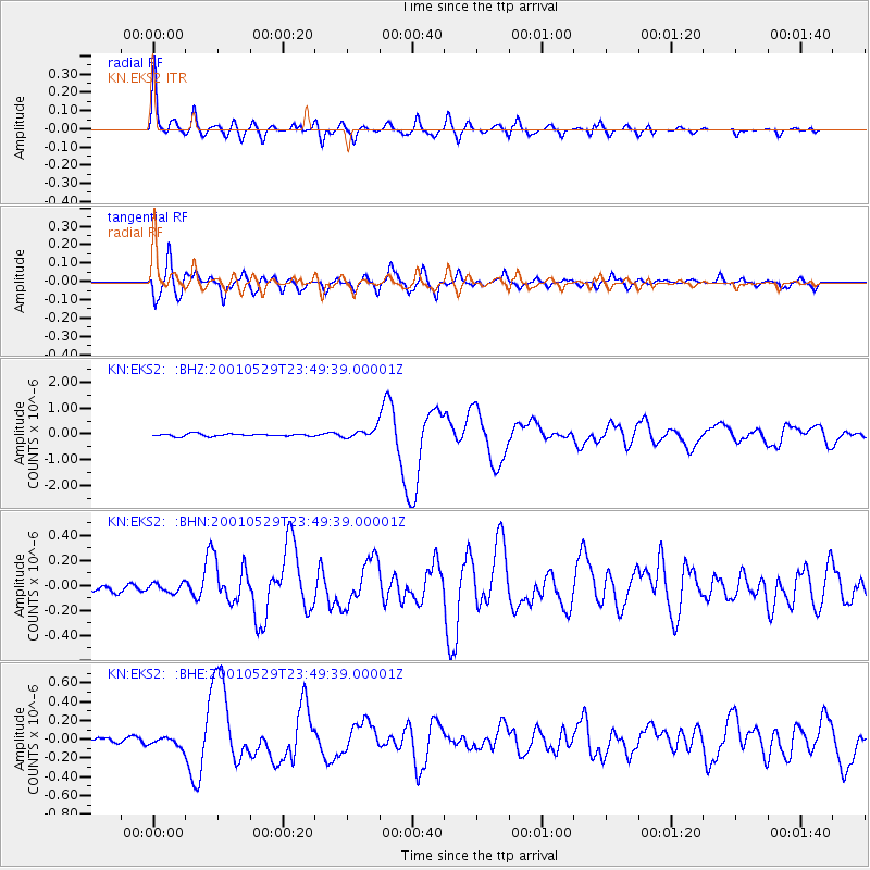
Signal To Noise
| Channel | StoN | STA | LTA |
| KN:EKS2: :BHN:20010529T23:49:39.00001Z | 0.9250603 | 3.580383E-8 | 3.870432E-8 |
| KN:EKS2: :BHE:20010529T23:49:39.00001Z | 2.1622782 | 5.139744E-8 | 2.377004E-8 |
| KN:EKS2: :BHZ:20010529T23:49:39.00001Z | 3.6040065 | 1.7542867E-7 | 4.8676014E-8 |
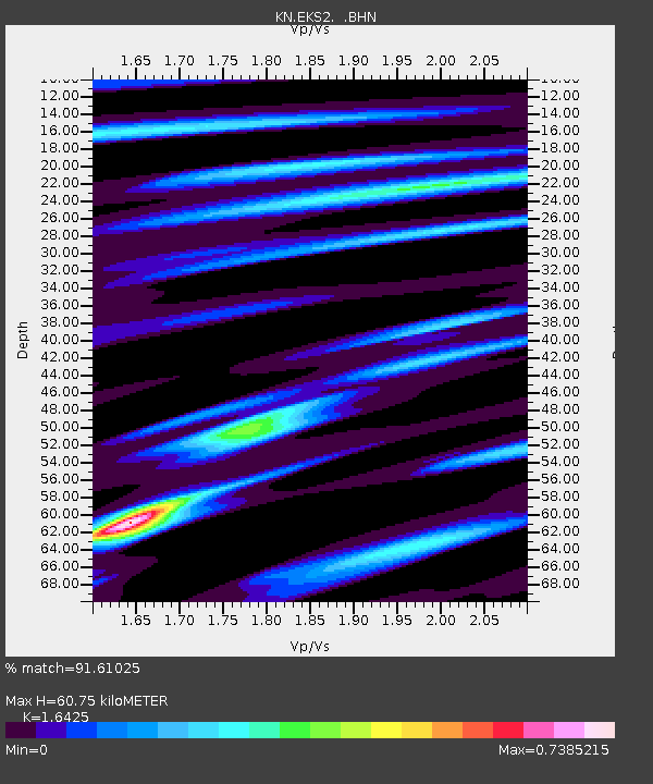
| Arrivals | |
| Ps | 6.3 SECOND |
| PpPs | 25 SECOND |
| PsPs/PpSs | 31 SECOND |

