
EKS2 KN.EKS2 - Earthquake Result Viewer
| ||||||||||||||||||
| ||||||||||||||||||
| ||||||||||||||||||
|
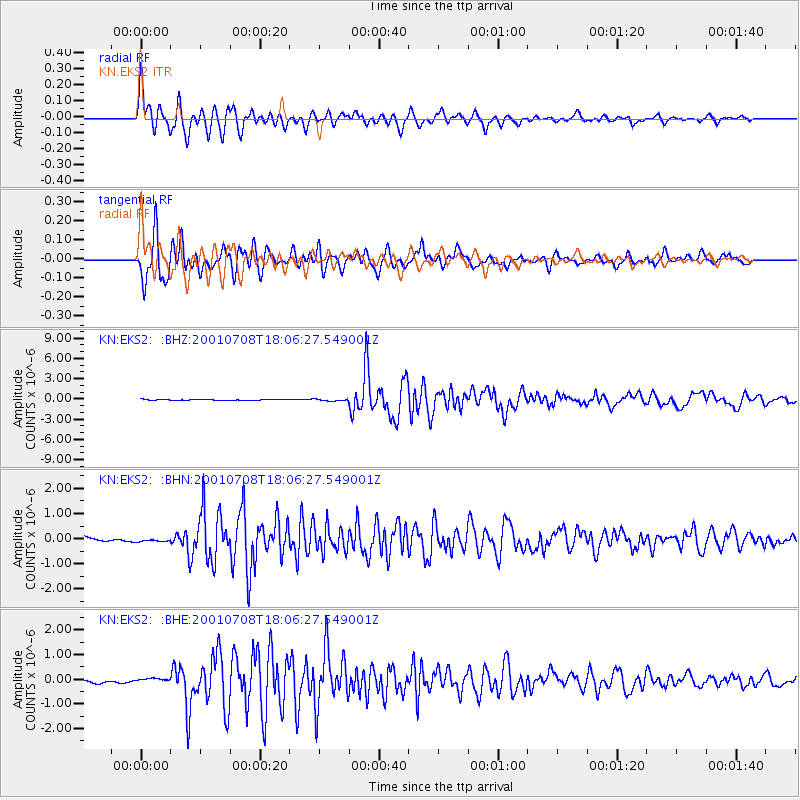
Signal To Noise
| Channel | StoN | STA | LTA |
| KN:EKS2: :BHN:20010708T18:06:27.549001Z | 0.8592115 | 6.868574E-8 | 7.9940435E-8 |
| KN:EKS2: :BHE:20010708T18:06:27.549001Z | 1.1599882 | 7.4877946E-8 | 6.455061E-8 |
| KN:EKS2: :BHZ:20010708T18:06:27.549001Z | 1.701903 | 1.188953E-7 | 6.9860214E-8 |
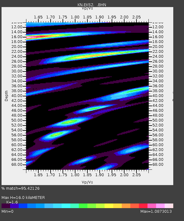
| Arrivals | |
| Ps | 1.6 SECOND |
| PpPs | 6.4 SECOND |
| PsPs/PpSs | 8.0 SECOND |

