
EKS2 KN.EKS2 - Earthquake Result Viewer
| ||||||||||||||||||
| ||||||||||||||||||
| ||||||||||||||||||
|
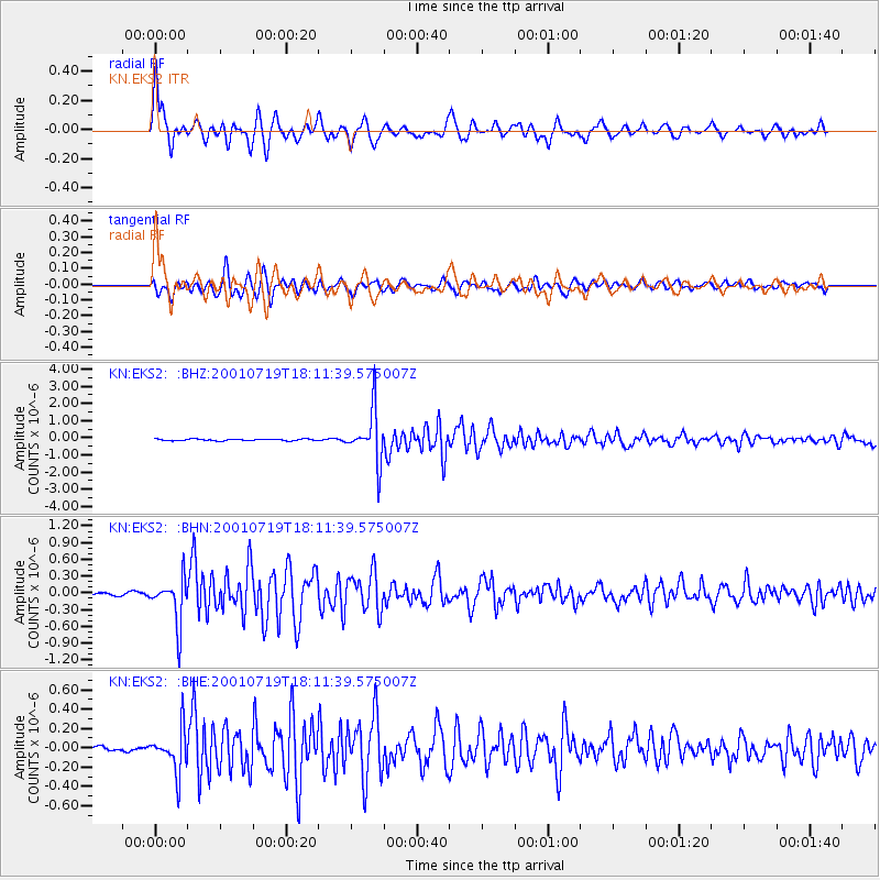
Signal To Noise
| Channel | StoN | STA | LTA |
| KN:EKS2: :BHN:20010719T18:11:39.575007Z | 14.324324 | 4.03442E-7 | 2.816482E-8 |
| KN:EKS2: :BHE:20010719T18:11:39.575007Z | 9.3414345 | 2.226054E-7 | 2.3829893E-8 |
| KN:EKS2: :BHZ:20010719T18:11:39.575007Z | 31.975378 | 1.5133604E-6 | 4.732893E-8 |
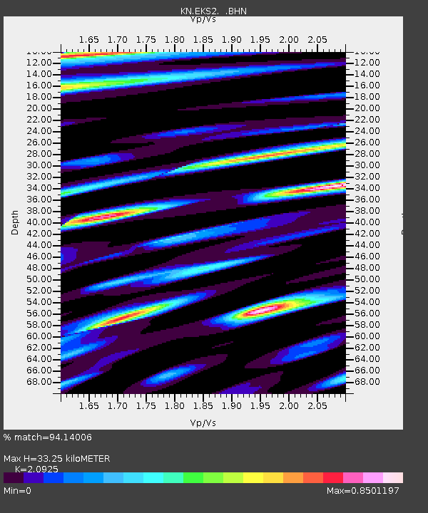
| Arrivals | |
| Ps | 5.9 SECOND |
| PpPs | 16 SECOND |
| PsPs/PpSs | 22 SECOND |

