You are here: Home > Network List > KN - Kyrgyz Seismic Telemetry Network Stations List
> Station EKS2 KN.EKS2 > Earthquake Result Viewer
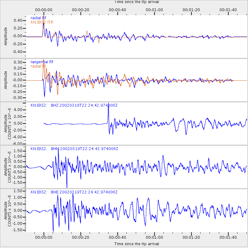
EKS2 KN.EKS2 - Earthquake Result Viewer

| Earthquake location: |
Banda Sea |
| Earthquake latitude/longitude: |
-6.5/129.9 |
| Earthquake time(UTC): |
2002/03/19 (078) 22:14:14 GMT |
| Earthquake Depth: |
148 km |
| Earthquake Magnitude: |
5.7 MB, 6.1 MW, 6.0 MW |
| Earthquake Catalog/Contributor: |
WHDF/NEIC |
|
| Network: |
KN Kyrgyz Seismic Telemetry Network |
| Station: |
EKS2 KN.EKS2 |
| Lat/Lon: |
42.66 N/73.78 E |
| Elevation: |
1360 m |
|
| Distance: |
70.6 deg |
| Az: |
319.501 deg |
| Baz: |
118.971 deg |
| Ray Param: |
0.054507483 |
| Estimated Moho Depth: |
15.5 km |
| Estimated Crust Vp/Vs: |
1.61 |
| Assumed Crust Vp: |
6.316 km/s |
| Estimated Crust Vs: |
3.935 km/s |
| Estimated Crust Poisson's Ratio: |
0.18 |
|
| Radial Match: |
91.690704 % |
| Radial Bump: |
400 |
| Transverse Match: |
84.64013 % |
| Transverse Bump: |
400 |
| SOD ConfigId: |
20082 |
| Insert Time: |
2010-03-08 19:44:07.390 +0000 |
| GWidth: |
2.5 |
| Max Bumps: |
400 |
| Tol: |
0.001 |
|
Signal To Noise
| Channel | StoN | STA | LTA |
| KN:EKS2: :BHN:20020319T22:24:42.974006Z | 1.6223854 | 1.3183517E-7 | 8.1260076E-8 |
| KN:EKS2: :BHE:20020319T22:24:42.974006Z | 1.7026157 | 1.18797935E-7 | 6.977378E-8 |
| KN:EKS2: :BHZ:20020319T22:24:42.974006Z | 6.7877326 | 5.354502E-7 | 7.888499E-8 |
| Arrivals |
| Ps | 1.5 SECOND |
| PpPs | 6.2 SECOND |
| PsPs/PpSs | 7.7 SECOND |


