EKS2 KN.EKS2 - Earthquake Result Viewer
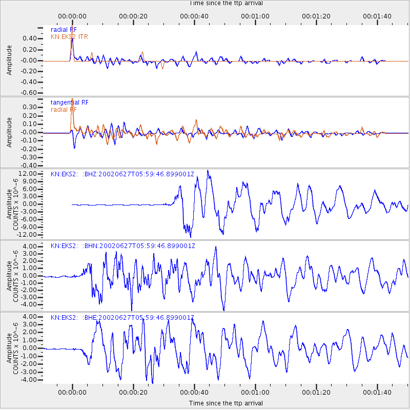
Earthquake location: Sunda Strait, Indonesia
Earthquake latitude/longitude: -7.0/104.2
Earthquake time(UTC): 2002/06/27 (178) 05:50:35 GMT
Earthquake Depth: 11 km
Earthquake Magnitude: 6.0 MB, 6.9 MS, 6.6 MW, 6.5 MW
Earthquake Catalog/Contributor: WHDF/NEIC
Network: KN Kyrgyz Seismic Telemetry Network
Station: EKS2 KN.EKS2
Lat/Lon: 42.66 N/73.78 E
Elevation: 1360 m
Distance: 56.6 deg
Az: 333.444 deg
Baz: 143.009 deg
Ray Param: 0.06402354
Estimated Moho Depth: 48.5 km
Estimated Crust Vp/Vs: 2.06
Assumed Crust Vp: 6.316 km/s
Estimated Crust Vs: 3.073 km/s
Estimated Crust Poisson's Ratio: 0.34
Radial Match: 94.23776 %
Radial Bump: 400
Transverse Match: 87.03689 %
Transverse Bump: 400
SOD ConfigId: 20082
Insert Time: 2010-03-08 19:44:30.537 +0000
GWidth: 2.5
Max Bumps: 400
Tol: 0.001

Signal To Noise

ChannelStoNSTALTA
KN:EKS2: :BHN:20020627T05:59:46.899001Z8.8832053.9849496E-74.4859366E-8
KN:EKS2: :BHE:20020627T05:59:46.899001Z8.1607853.7052297E-74.5402864E-8
KN:EKS2: :BHZ:20020627T05:59:46.899001Z21.5635191.5372297E-67.128844E-8
Arrivals
Ps8.4 SECOND
PpPs22 SECOND
PsPs/PpSs31 SECOND