EKS2 KN.EKS2 - Earthquake Result Viewer
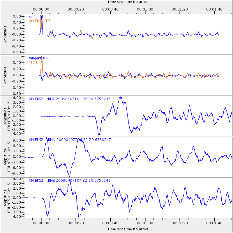
Earthquake location: Kuril Islands
Earthquake latitude/longitude: 46.0/151.5
Earthquake time(UTC): 2009/04/07 (097) 04:23:33 GMT
Earthquake Depth: 31 km
Earthquake Magnitude: 6.5 MB, 6.8 MS, 6.9 MW, 6.9 MW
Earthquake Catalog/Contributor: WHDF/NEIC
Network: KN Kyrgyz Seismic Telemetry Network
Station: EKS2 KN.EKS2
Lat/Lon: 42.66 N/73.78 E
Elevation: 1360 m
Distance: 53.6 deg
Az: 296.417 deg
Baz: 57.734 deg
Ray Param: 0.06593097
Estimated Moho Depth: 46.75 km
Estimated Crust Vp/Vs: 1.68
Assumed Crust Vp: 6.316 km/s
Estimated Crust Vs: 3.77 km/s
Estimated Crust Poisson's Ratio: 0.22
Radial Match: 95.5254 %
Radial Bump: 400
Transverse Match: 82.388985 %
Transverse Bump: 400
SOD ConfigId: 2658
Insert Time: 2010-03-08 19:44:46.598 +0000
GWidth: 2.5
Max Bumps: 400
Tol: 0.001

Signal To Noise

ChannelStoNSTALTA
KN:EKS2: :BHN:20090407T04:32:20.675024Z63.7883835.3180543E-68.337026E-8
KN:EKS2: :BHE:20090407T04:32:20.675024Z29.6324121.9291049E-66.5101176E-8
KN:EKS2: :BHZ:20090407T04:32:20.675024Z50.88242.2063539E-64.3361823E-8
Arrivals
Ps5.3 SECOND
PpPs19 SECOND
PsPs/PpSs24 SECOND