
EKS2 KN.EKS2 - Earthquake Result Viewer
| ||||||||||||||||||
| ||||||||||||||||||
| ||||||||||||||||||
|
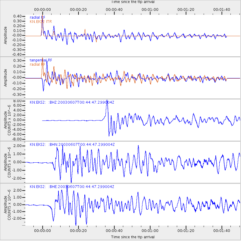
Signal To Noise
| Channel | StoN | STA | LTA |
| KN:EKS2: :BHN:20030607T00:44:47.299004Z | 0.9474909 | 2.998773E-8 | 3.1649627E-8 |
| KN:EKS2: :BHE:20030607T00:44:47.299004Z | 6.006039 | 1.4161988E-7 | 2.357958E-8 |
| KN:EKS2: :BHZ:20030607T00:44:47.299004Z | 10.451627 | 5.077144E-7 | 4.8577547E-8 |
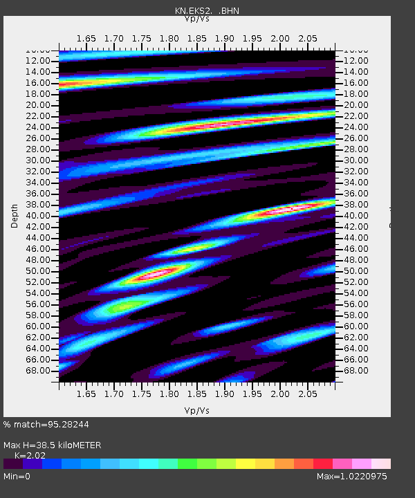
| Arrivals | |
| Ps | 6.3 SECOND |
| PpPs | 18 SECOND |
| PsPs/PpSs | 24 SECOND |

