
EKS2 KN.EKS2 - Earthquake Result Viewer
| ||||||||||||||||||
| ||||||||||||||||||
| ||||||||||||||||||
|
Signal To Noise
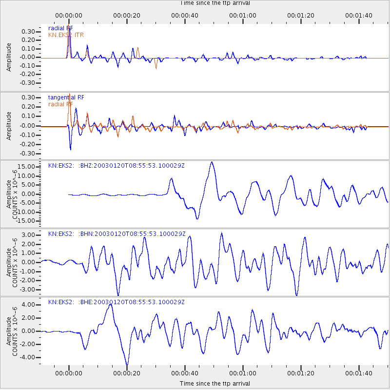
| Channel | StoN | STA | LTA |
| KN:EKS2: :BHN:20030120T08:55:53.100029Z | 0.91844344 | 3.0599023E-7 | 3.3316175E-7 |
| KN:EKS2: :BHE:20030120T08:55:53.100029Z | 1.7752695 | 4.3222965E-7 | 2.434727E-7 |
| KN:EKS2: :BHZ:20030120T08:55:53.100029Z | 6.412818 | 1.7537685E-6 | 2.734786E-7 |
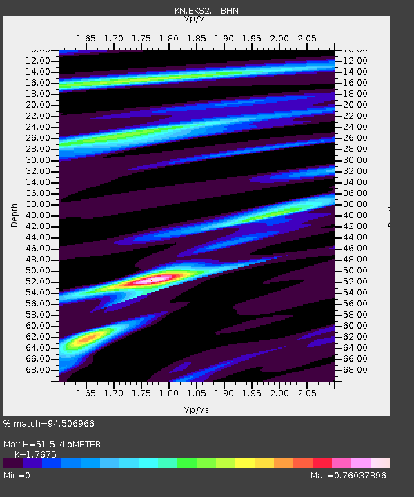
| Arrivals | |
| Ps | 6.4 SECOND |
| PpPs | 22 SECOND |
| PsPs/PpSs | 29 SECOND |

