
EKS2 KN.EKS2 - Earthquake Result Viewer
| ||||||||||||||||||
| ||||||||||||||||||
| ||||||||||||||||||
|
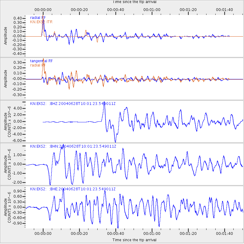
Signal To Noise
| Channel | StoN | STA | LTA |
| KN:EKS2: :BHN:20040628T10:01:23.549011Z | 27.412884 | 9.0627043E-7 | 3.306002E-8 |
| KN:EKS2: :BHE:20040628T10:01:23.549011Z | 4.196521 | 2.6595745E-7 | 6.337571E-8 |
| KN:EKS2: :BHZ:20040628T10:01:23.549011Z | 34.409492 | 2.3738048E-6 | 6.8986914E-8 |
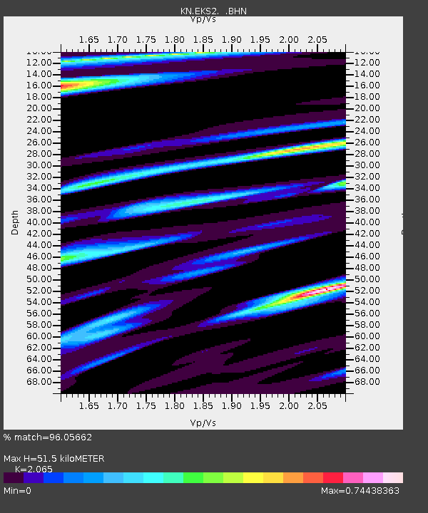
| Arrivals | |
| Ps | 8.9 SECOND |
| PpPs | 24 SECOND |
| PsPs/PpSs | 33 SECOND |

