You are here: Home > Network List > CI - Caltech Regional Seismic Network Stations List
> Station MPM Manuel Prospect Mine, California, USA > Earthquake Result Viewer
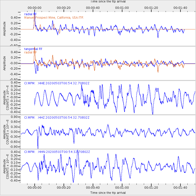
MPM Manuel Prospect Mine, California, USA - Earthquake Result Viewer
*The percent match for this event was below the threshold and hence no stack was calculated.
| Earthquake location: |
Southern Peru |
| Earthquake latitude/longitude: |
-15.3/-70.4 |
| Earthquake time(UTC): |
2020/05/03 (124) 00:44:26 GMT |
| Earthquake Depth: |
186 km |
| Earthquake Magnitude: |
5.7 Mww |
| Earthquake Catalog/Contributor: |
NEIC PDE/us |
|
| Network: |
CI Caltech Regional Seismic Network |
| Station: |
MPM Manuel Prospect Mine, California, USA |
| Lat/Lon: |
36.06 N/117.49 W |
| Elevation: |
185 m |
|
| Distance: |
67.8 deg |
| Az: |
320.132 deg |
| Baz: |
130.242 deg |
| Ray Param: |
$rayparam |
*The percent match for this event was below the threshold and hence was not used in the summary stack. |
|
| Radial Match: |
58.261612 % |
| Radial Bump: |
372 |
| Transverse Match: |
59.339165 % |
| Transverse Bump: |
360 |
| SOD ConfigId: |
21166931 |
| Insert Time: |
2020-05-17 00:49:08.534 +0000 |
| GWidth: |
2.5 |
| Max Bumps: |
400 |
| Tol: |
0.001 |
|
Signal To Noise
| Channel | StoN | STA | LTA |
| CI:MPM: :HHZ:20200503T00:54:32.70802Z | 2.9405842 | 2.6367837E-7 | 8.96687E-8 |
| CI:MPM: :HHN:20200503T00:54:32.70802Z | 1.2076789 | 1.2466825E-7 | 1.0322964E-7 |
| CI:MPM: :HHE:20200503T00:54:32.70802Z | 1.0877016 | 1.3563901E-7 | 1.2470241E-7 |
| Arrivals |
| Ps | |
| PpPs | |
| PsPs/PpSs | |


