
EKS2 KN.EKS2 - Earthquake Result Viewer
| ||||||||||||||||||
| ||||||||||||||||||
| ||||||||||||||||||
|
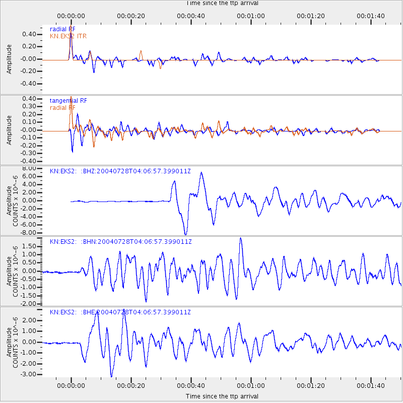
Signal To Noise
| Channel | StoN | STA | LTA |
| KN:EKS2: :BHN:20040728T04:06:57.399011Z | 2.6031165 | 9.477295E-8 | 3.6407492E-8 |
| KN:EKS2: :BHE:20040728T04:06:57.399011Z | 15.483116 | 7.071143E-7 | 4.5670024E-8 |
| KN:EKS2: :BHZ:20040728T04:06:57.399011Z | 30.852186 | 2.145993E-6 | 6.955724E-8 |
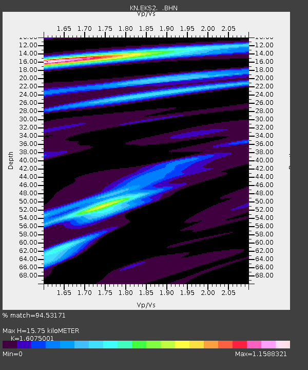
| Arrivals | |
| Ps | 1.6 SECOND |
| PpPs | 6.2 SECOND |
| PsPs/PpSs | 7.8 SECOND |

