
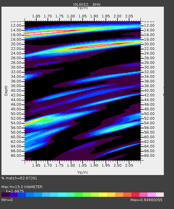
EKS2 KN.EKS2 - Earthquake Result Viewer
| ||||||||||||||||||
| ||||||||||||||||||
| ||||||||||||||||||
|
Signal To Noise
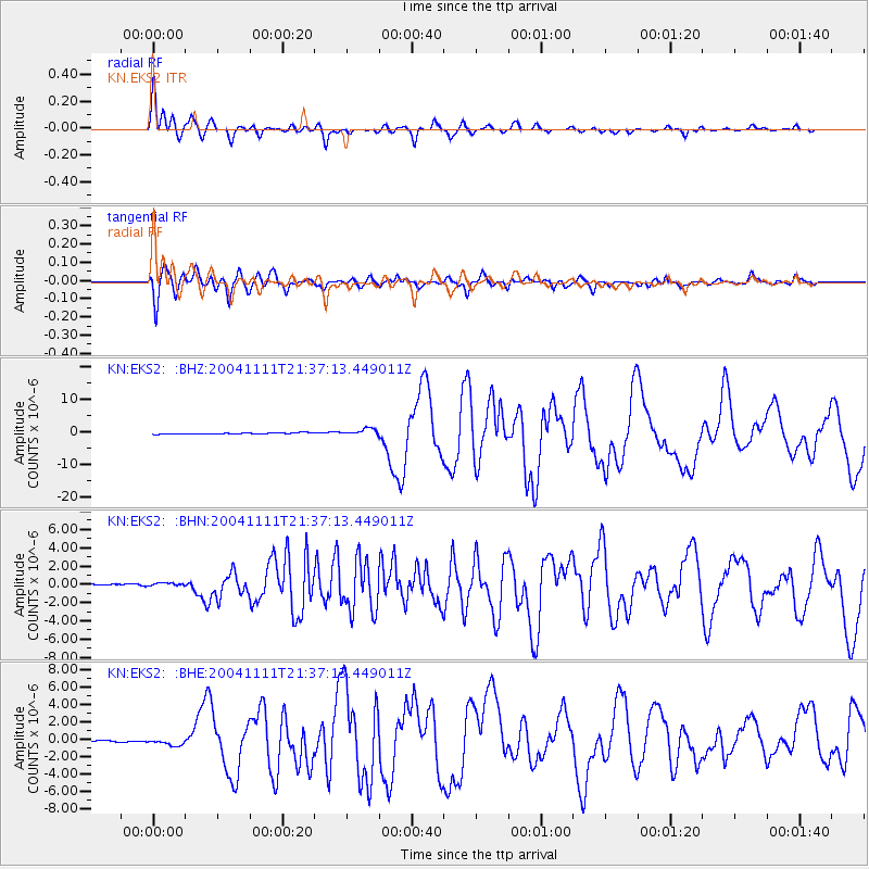
| Channel | StoN | STA | LTA |
| KN:EKS2: :BHN:20041111T21:37:13.449011Z | 1.6398704 | 2.5254593E-7 | 1.5400359E-7 |
| KN:EKS2: :BHE:20041111T21:37:13.449011Z | 5.1500287 | 4.0338907E-7 | 7.832753E-8 |
| KN:EKS2: :BHZ:20041111T21:37:13.449011Z | 5.6415043 | 1.0389397E-6 | 1.8416004E-7 |
| Arrivals | |
| Ps | 1.6 SECOND |
| PpPs | 6.1 SECOND |
| PsPs/PpSs | 7.7 SECOND |

