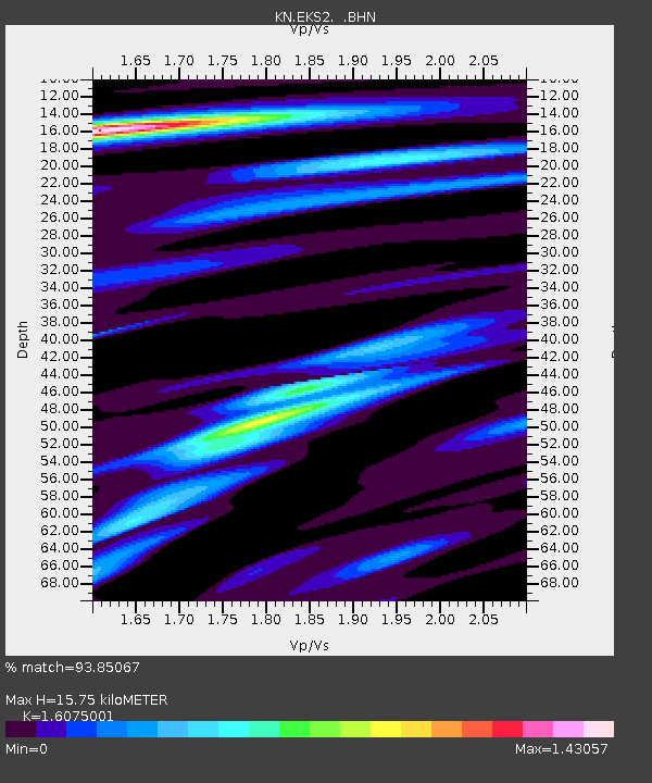
EKS2 KN.EKS2 - Earthquake Result Viewer
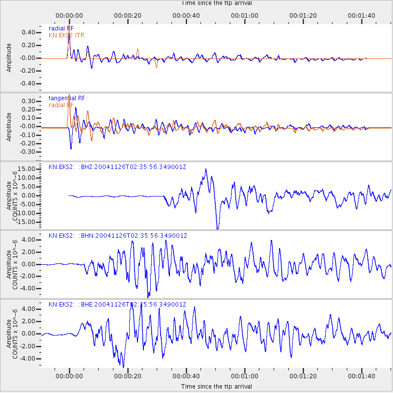
Earthquake location: Irian Jaya Region, Indonesia
Earthquake latitude/longitude: -3.6/135.4
Earthquake time(UTC): 2004/11/26 (331) 02:25:03 GMT
Earthquake Depth: 10 km
Earthquake Magnitude: 6.2 MB, 7.2 MS, 7.1 MW, 7.0 MW
Earthquake Catalog/Contributor: WHDF/NEIC
Network: KN Kyrgyz Seismic Telemetry Network
Station: EKS2 KN.EKS2
Lat/Lon: 42.66 N/73.78 E
Elevation: 1360 m
Distance: 72.1 deg
Az: 316.992 deg
Baz: 112.646 deg
Ray Param: 0.053896725
Estimated Moho Depth: 15.75 km
Estimated Crust Vp/Vs: 1.61
Assumed Crust Vp: 6.316 km/s
Estimated Crust Vs: 3.929 km/s
Estimated Crust Poisson's Ratio: 0.18
Radial Match: 93.85067 %
Radial Bump: 400
Transverse Match: 93.67344 %
Transverse Bump: 400
SOD ConfigId: 2459
Insert Time: 2010-03-08 19:46:12.234 +0000
GWidth: 2.5
Max Bumps: 400
Tol: 0.001

Signal To Noise

ChannelStoNSTALTA
KN:EKS2: :BHN:20041126T02:35:56.349001Z2.05517772.0220102E-79.838615E-8
KN:EKS2: :BHE:20041126T02:35:56.349001Z3.64895687.911541E-72.1681652E-7
KN:EKS2: :BHZ:20041126T02:35:56.349001Z9.8705822.4160577E-62.447736E-7
Arrivals
Ps1.6 SECOND
PpPs6.3 SECOND
PsPs/PpSs7.8 SECOND