You are here: Home > Network List > IU - Global Seismograph Network (GSN - IRIS/USGS) Stations List
> Station RSSD Black Hills, South Dakota, USA > Earthquake Result Viewer
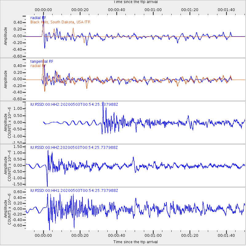
RSSD Black Hills, South Dakota, USA - Earthquake Result Viewer
*The percent match for this event was below the threshold and hence no stack was calculated.
| Earthquake location: |
Southern Peru |
| Earthquake latitude/longitude: |
-15.3/-70.4 |
| Earthquake time(UTC): |
2020/05/03 (124) 00:44:26 GMT |
| Earthquake Depth: |
186 km |
| Earthquake Magnitude: |
5.7 Mww |
| Earthquake Catalog/Contributor: |
NEIC PDE/us |
|
| Network: |
IU Global Seismograph Network (GSN - IRIS/USGS) |
| Station: |
RSSD Black Hills, South Dakota, USA |
| Lat/Lon: |
44.12 N/104.04 W |
| Elevation: |
2090 m |
|
| Distance: |
66.6 deg |
| Az: |
334.256 deg |
| Baz: |
144.414 deg |
| Ray Param: |
$rayparam |
*The percent match for this event was below the threshold and hence was not used in the summary stack. |
|
| Radial Match: |
59.195694 % |
| Radial Bump: |
400 |
| Transverse Match: |
67.417984 % |
| Transverse Bump: |
400 |
| SOD ConfigId: |
21166931 |
| Insert Time: |
2020-05-17 00:53:23.367 +0000 |
| GWidth: |
2.5 |
| Max Bumps: |
400 |
| Tol: |
0.001 |
|
Signal To Noise
| Channel | StoN | STA | LTA |
| IU:RSSD:00:HHZ:20200503T00:54:25.737988Z | 5.9920707 | 5.6290213E-7 | 9.394117E-8 |
| IU:RSSD:00:HH1:20200503T00:54:25.737988Z | 2.5470235 | 2.5859512E-7 | 1.01528364E-7 |
| IU:RSSD:00:HH2:20200503T00:54:25.737988Z | 5.809348 | 4.549758E-7 | 7.8317875E-8 |
| Arrivals |
| Ps | |
| PpPs | |
| PsPs/PpSs | |


