You are here: Home > Network List > TA - USArray Transportable Network (new EarthScope stations) Stations List
> Station I30M Mount Dempster, Yukon, CAN > Earthquake Result Viewer
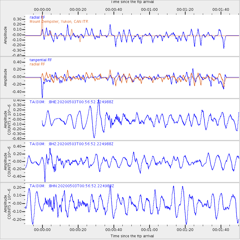
I30M Mount Dempster, Yukon, CAN - Earthquake Result Viewer
*The percent match for this event was below the threshold and hence no stack was calculated.
| Earthquake location: |
Southern Peru |
| Earthquake latitude/longitude: |
-15.3/-70.4 |
| Earthquake time(UTC): |
2020/05/03 (124) 00:44:26 GMT |
| Earthquake Depth: |
186 km |
| Earthquake Magnitude: |
5.7 Mww |
| Earthquake Catalog/Contributor: |
NEIC PDE/us |
|
| Network: |
TA USArray Transportable Network (new EarthScope stations) |
| Station: |
I30M Mount Dempster, Yukon, CAN |
| Lat/Lon: |
65.22 N/136.38 W |
| Elevation: |
1399 m |
|
| Distance: |
94.2 deg |
| Az: |
337.301 deg |
| Baz: |
117.929 deg |
| Ray Param: |
$rayparam |
*The percent match for this event was below the threshold and hence was not used in the summary stack. |
|
| Radial Match: |
45.79671 % |
| Radial Bump: |
355 |
| Transverse Match: |
56.530956 % |
| Transverse Bump: |
400 |
| SOD ConfigId: |
21166931 |
| Insert Time: |
2020-05-17 01:01:42.196 +0000 |
| GWidth: |
2.5 |
| Max Bumps: |
400 |
| Tol: |
0.001 |
|
Signal To Noise
| Channel | StoN | STA | LTA |
| TA:I30M: :BHZ:20200503T00:56:52.224988Z | 1.7247986 | 1.9886795E-7 | 1.1529924E-7 |
| TA:I30M: :BHN:20200503T00:56:52.224988Z | 0.60118645 | 4.7707804E-8 | 7.9356084E-8 |
| TA:I30M: :BHE:20200503T00:56:52.224988Z | 2.3622787 | 2.3882515E-7 | 1.0109949E-7 |
| Arrivals |
| Ps | |
| PpPs | |
| PsPs/PpSs | |


