You are here: Home > Network List > TA - USArray Transportable Network (new EarthScope stations) Stations List
> Station R33M Jennings River, BC, CAN > Earthquake Result Viewer
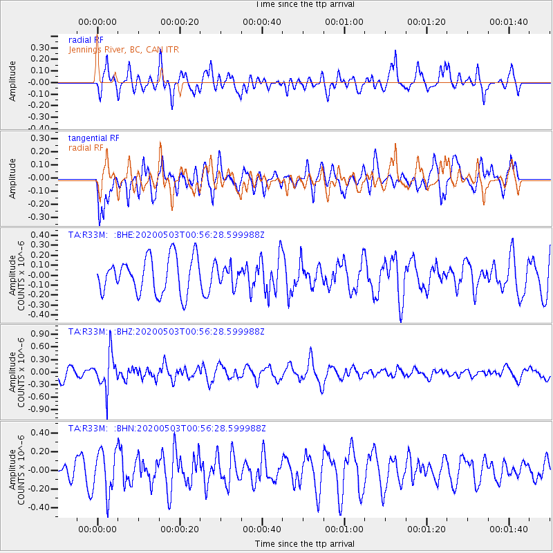
R33M Jennings River, BC, CAN - Earthquake Result Viewer
*The percent match for this event was below the threshold and hence no stack was calculated.
| Earthquake location: |
Southern Peru |
| Earthquake latitude/longitude: |
-15.3/-70.4 |
| Earthquake time(UTC): |
2020/05/03 (124) 00:44:26 GMT |
| Earthquake Depth: |
186 km |
| Earthquake Magnitude: |
5.7 Mww |
| Earthquake Catalog/Contributor: |
NEIC PDE/us |
|
| Network: |
TA USArray Transportable Network (new EarthScope stations) |
| Station: |
R33M Jennings River, BC, CAN |
| Lat/Lon: |
59.39 N/130.97 W |
| Elevation: |
1437 m |
|
| Distance: |
89.0 deg |
| Az: |
333.538 deg |
| Baz: |
122.824 deg |
| Ray Param: |
$rayparam |
*The percent match for this event was below the threshold and hence was not used in the summary stack. |
|
| Radial Match: |
55.724056 % |
| Radial Bump: |
400 |
| Transverse Match: |
65.605156 % |
| Transverse Bump: |
400 |
| SOD ConfigId: |
21166931 |
| Insert Time: |
2020-05-17 01:01:54.891 +0000 |
| GWidth: |
2.5 |
| Max Bumps: |
400 |
| Tol: |
0.001 |
|
Signal To Noise
| Channel | StoN | STA | LTA |
| TA:R33M: :BHZ:20200503T00:56:28.599988Z | 2.4792633 | 4.2858633E-7 | 1.7286841E-7 |
| TA:R33M: :BHN:20200503T00:56:28.599988Z | 1.8591638 | 2.2814349E-7 | 1.2271296E-7 |
| TA:R33M: :BHE:20200503T00:56:28.599988Z | 0.5075655 | 9.1711726E-8 | 1.8068945E-7 |
| Arrivals |
| Ps | |
| PpPs | |
| PsPs/PpSs | |


