
EKS2 KN.EKS2 - Earthquake Result Viewer
| ||||||||||||||||||
| ||||||||||||||||||
| ||||||||||||||||||
|
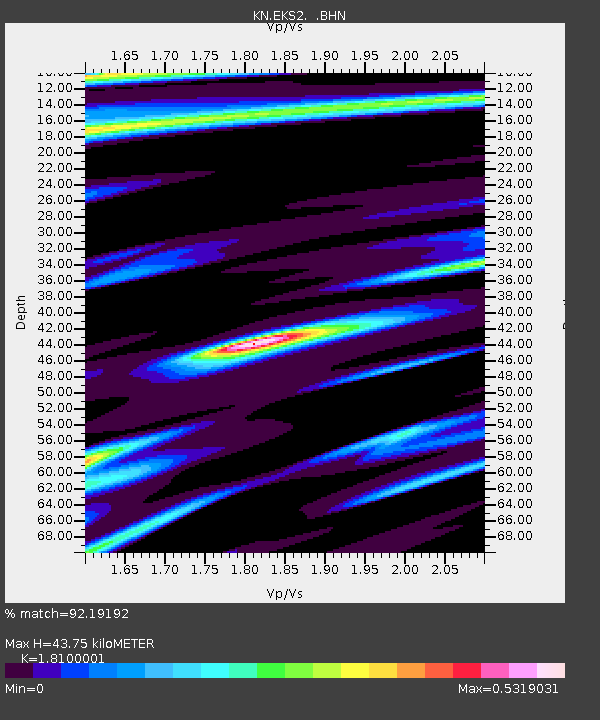
Signal To Noise
| Channel | StoN | STA | LTA |
| KN:EKS2: :BHN:20080303T09:39:58.924011Z | 7.5879173 | 8.376926E-7 | 1.1039822E-7 |
| KN:EKS2: :BHE:20080303T09:39:58.924011Z | 17.534693 | 1.036331E-6 | 5.910175E-8 |
| KN:EKS2: :BHZ:20080303T09:39:58.924011Z | 21.80433 | 2.828443E-6 | 1.2971933E-7 |
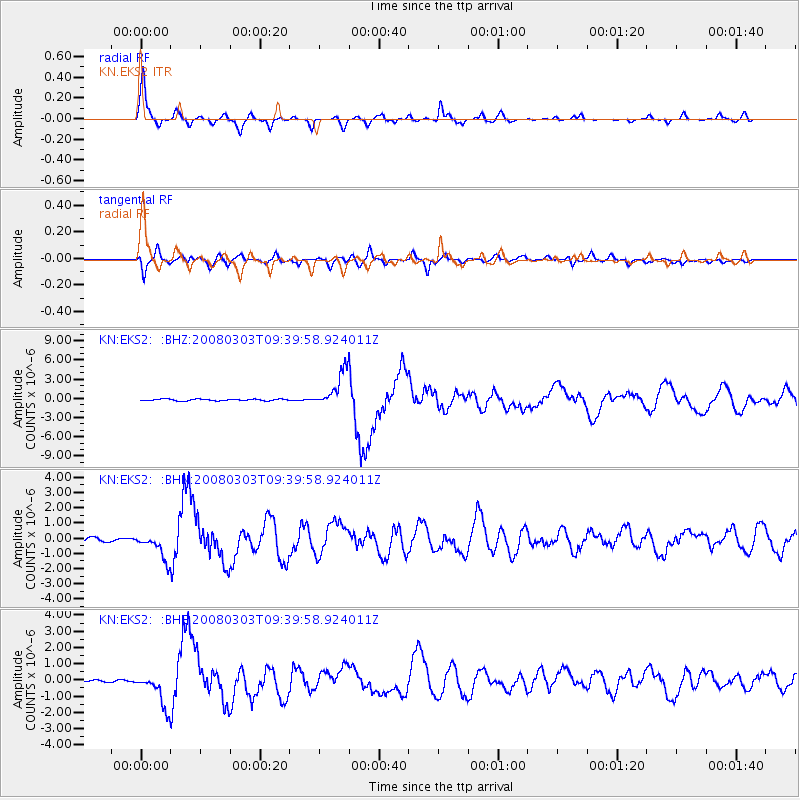
| Arrivals | |
| Ps | 5.9 SECOND |
| PpPs | 19 SECOND |
| PsPs/PpSs | 24 SECOND |

