EKS2 KN.EKS2 - Earthquake Result Viewer
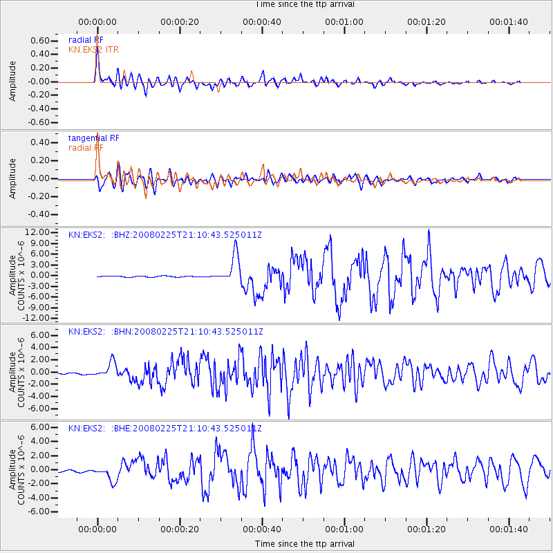
Earthquake location: Southern Sumatra, Indonesia
Earthquake latitude/longitude: -2.2/99.8
Earthquake time(UTC): 2008/02/25 (056) 21:02:18 GMT
Earthquake Depth: 25 km
Earthquake Magnitude: 6.2 MB, 6.6 MS, 6.6 MW, 6.5 MW
Earthquake Catalog/Contributor: WHDF/NEIC
Network: KN Kyrgyz Seismic Telemetry Network
Station: EKS2 KN.EKS2
Lat/Lon: 42.66 N/73.78 E
Elevation: 1360 m
Distance: 50.5 deg
Az: 335.197 deg
Baz: 145.369 deg
Ray Param: 0.06797208
Estimated Moho Depth: 49.0 km
Estimated Crust Vp/Vs: 1.62
Assumed Crust Vp: 6.316 km/s
Estimated Crust Vs: 3.898 km/s
Estimated Crust Poisson's Ratio: 0.19
Radial Match: 94.18099 %
Radial Bump: 400
Transverse Match: 84.3638 %
Transverse Bump: 400
SOD ConfigId: 2564
Insert Time: 2010-03-08 19:47:58.298 +0000
GWidth: 2.5
Max Bumps: 400
Tol: 0.001

Signal To Noise

ChannelStoNSTALTA
KN:EKS2: :BHN:20080225T21:10:43.525011Z10.8353521.3235081E-61.2214721E-7
KN:EKS2: :BHE:20080225T21:10:43.525011Z8.4800971.1787993E-61.3900777E-7
KN:EKS2: :BHZ:20080225T21:10:43.525011Z27.4657884.1890653E-61.5251939E-7
Arrivals
Ps5.1 SECOND
PpPs19 SECOND
PsPs/PpSs24 SECOND