EKS2 KN.EKS2 - Earthquake Result Viewer
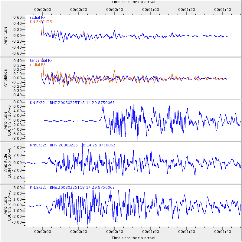
Earthquake location: Southern Sumatra, Indonesia
Earthquake latitude/longitude: -2.3/99.9
Earthquake time(UTC): 2008/02/25 (056) 18:06:03 GMT
Earthquake Depth: 25 km
Earthquake Magnitude: 6.0 MB, 6.4 MS, 6.4 MW, 6.3 MW
Earthquake Catalog/Contributor: WHDF/NEIC
Network: KN Kyrgyz Seismic Telemetry Network
Station: EKS2 KN.EKS2
Lat/Lon: 42.66 N/73.78 E
Elevation: 1360 m
Distance: 50.6 deg
Az: 335.162 deg
Baz: 145.319 deg
Ray Param: 0.06789531
Estimated Moho Depth: 19.0 km
Estimated Crust Vp/Vs: 2.00
Assumed Crust Vp: 6.316 km/s
Estimated Crust Vs: 3.154 km/s
Estimated Crust Poisson's Ratio: 0.33
Radial Match: 93.12426 %
Radial Bump: 400
Transverse Match: 83.6195 %
Transverse Bump: 400
SOD ConfigId: 2564
Insert Time: 2010-03-08 19:48:00.199 +0000
GWidth: 2.5
Max Bumps: 400
Tol: 0.001

Signal To Noise

ChannelStoNSTALTA
KN:EKS2: :BHN:20080225T18:14:29.875006Z5.47629836.800806E-71.2418619E-7
KN:EKS2: :BHE:20080225T18:14:29.875006Z4.78345545.282149E-71.1042538E-7
KN:EKS2: :BHZ:20080225T18:14:29.875006Z14.9873722.2858683E-61.5251962E-7
Arrivals
Ps3.2 SECOND
PpPs8.6 SECOND
PsPs/PpSs12 SECOND