EKS2 KN.EKS2 - Earthquake Result Viewer
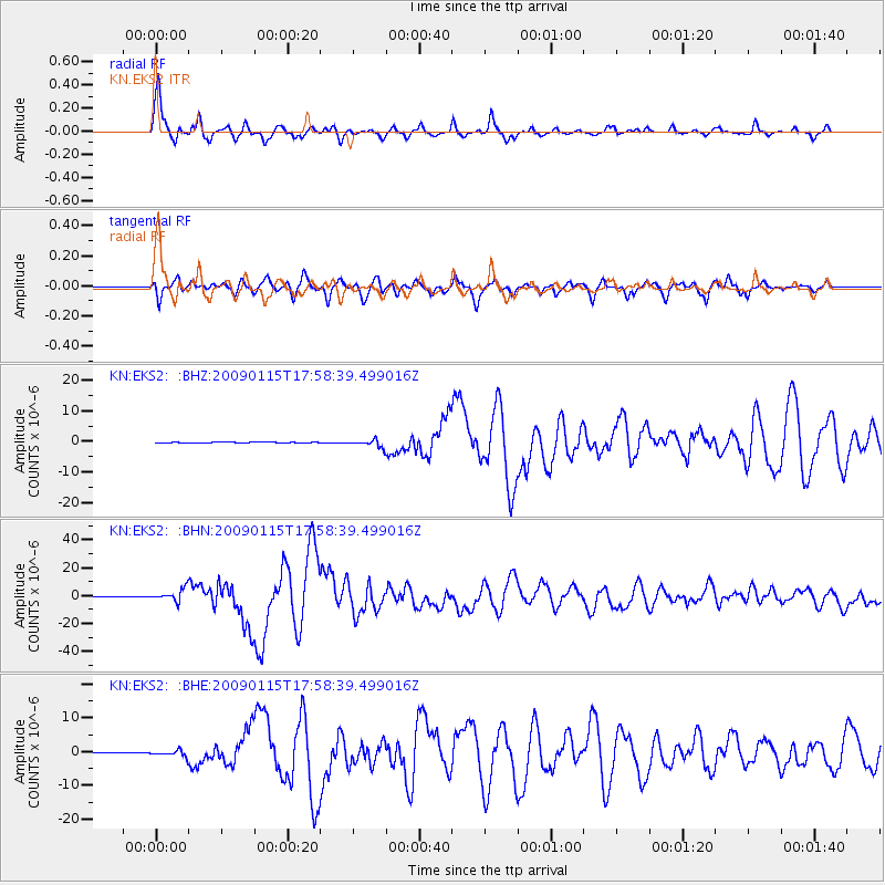
Earthquake location: East Of Kuril Islands
Earthquake latitude/longitude: 46.9/155.2
Earthquake time(UTC): 2009/01/15 (015) 17:49:39 GMT
Earthquake Depth: 36 km
Earthquake Magnitude: 6.9 MB, 7.5 MS, 7.4 MW, 7.4 MW
Earthquake Catalog/Contributor: WHDF/NEIC
Network: KN Kyrgyz Seismic Telemetry Network
Station: EKS2 KN.EKS2
Lat/Lon: 42.66 N/73.78 E
Elevation: 1360 m
Distance: 55.5 deg
Az: 297.702 deg
Baz: 55.459 deg
Ray Param: 0.06471153
Estimated Moho Depth: 17.25 km
Estimated Crust Vp/Vs: 1.60
Assumed Crust Vp: 6.316 km/s
Estimated Crust Vs: 3.947 km/s
Estimated Crust Poisson's Ratio: 0.18
Radial Match: 97.305916 %
Radial Bump: 400
Transverse Match: 89.113075 %
Transverse Bump: 400
SOD ConfigId: 2834
Insert Time: 2010-03-08 19:48:19.069 +0000
GWidth: 2.5
Max Bumps: 400
Tol: 0.001

Signal To Noise

ChannelStoNSTALTA
KN:EKS2: :BHN:20090115T17:58:39.499016Z33.3811764.368501E-61.308672E-7
KN:EKS2: :BHE:20090115T17:58:39.499016Z2.55898958.944738E-73.495418E-7
KN:EKS2: :BHZ:20090115T17:58:39.499016Z10.9590151.2013988E-61.09626534E-7
Arrivals
Ps1.7 SECOND
PpPs6.7 SECOND
PsPs/PpSs8.5 SECOND