
EKS2 KN.EKS2 - Earthquake Result Viewer
| ||||||||||||||||||
| ||||||||||||||||||
| ||||||||||||||||||
|
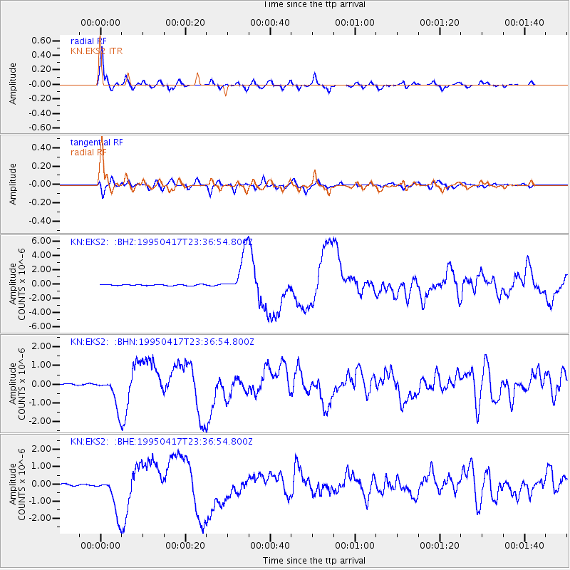
Signal To Noise
| Channel | StoN | STA | LTA |
| KN:EKS2: :BHN:19950417T23:36:54.800Z | 25.951239 | 8.592836E-7 | 3.3111466E-8 |
| KN:EKS2: :BHE:19950417T23:36:54.800Z | 27.38169 | 1.1527826E-6 | 4.2100496E-8 |
| KN:EKS2: :BHZ:19950417T23:36:54.800Z | 44.370777 | 3.0987176E-6 | 6.98369E-8 |
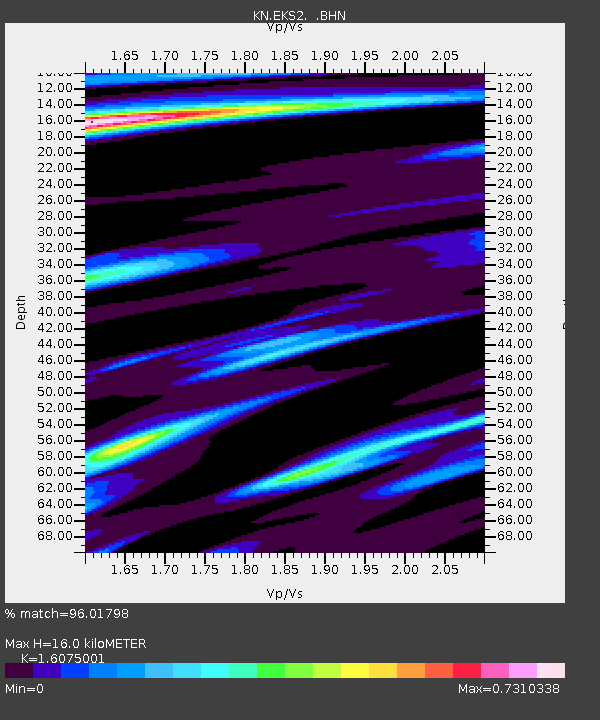
| Arrivals | |
| Ps | 1.6 SECOND |
| PpPs | 6.2 SECOND |
| PsPs/PpSs | 7.9 SECOND |

