You are here: Home > Network List > US - United States National Seismic Network Stations List
> Station AMTX Amarillo, Texas, USA > Earthquake Result Viewer
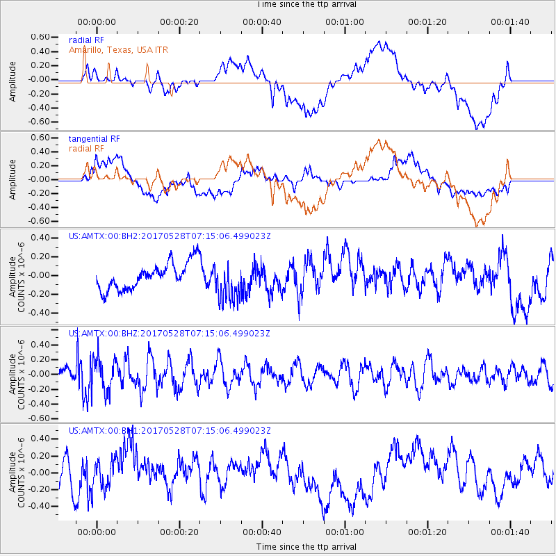
AMTX Amarillo, Texas, USA - Earthquake Result Viewer
*The percent match for this event was below the threshold and hence no stack was calculated.
| Earthquake location: |
Andreanof Islands, Aleutian Is. |
| Earthquake latitude/longitude: |
51.6/-175.3 |
| Earthquake time(UTC): |
2017/05/28 (148) 07:06:14 GMT |
| Earthquake Depth: |
8.0 km |
| Earthquake Magnitude: |
5.6 Ml |
| Earthquake Catalog/Contributor: |
NEIC PDE/at |
|
| Network: |
US United States National Seismic Network |
| Station: |
AMTX Amarillo, Texas, USA |
| Lat/Lon: |
34.53 N/101.41 W |
| Elevation: |
1010 m |
|
| Distance: |
54.3 deg |
| Az: |
77.69 deg |
| Baz: |
312.398 deg |
| Ray Param: |
$rayparam |
*The percent match for this event was below the threshold and hence was not used in the summary stack. |
|
| Radial Match: |
41.944366 % |
| Radial Bump: |
400 |
| Transverse Match: |
41.364838 % |
| Transverse Bump: |
400 |
| SOD ConfigId: |
2028011 |
| Insert Time: |
2017-06-11 07:12:14.233 +0000 |
| GWidth: |
2.5 |
| Max Bumps: |
400 |
| Tol: |
0.001 |
|
Signal To Noise
| Channel | StoN | STA | LTA |
| US:AMTX:00:BHZ:20170528T07:15:06.499023Z | 2.3466983 | 2.1447894E-7 | 9.139604E-8 |
| US:AMTX:00:BH1:20170528T07:15:06.499023Z | 0.87812984 | 1.6104651E-7 | 1.8339715E-7 |
| US:AMTX:00:BH2:20170528T07:15:06.499023Z | 1.5903682 | 2.0785633E-7 | 1.3069699E-7 |
| Arrivals |
| Ps | |
| PpPs | |
| PsPs/PpSs | |


