You are here: Home > Network List > US - United States National Seismic Network Stations List
> Station HAWA Hanford, Washington, USA > Earthquake Result Viewer
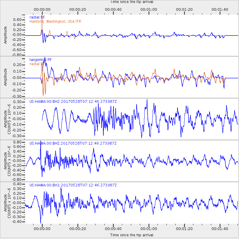
HAWA Hanford, Washington, USA - Earthquake Result Viewer
*The percent match for this event was below the threshold and hence no stack was calculated.
| Earthquake location: |
Andreanof Islands, Aleutian Is. |
| Earthquake latitude/longitude: |
51.6/-175.3 |
| Earthquake time(UTC): |
2017/05/28 (148) 07:06:14 GMT |
| Earthquake Depth: |
8.0 km |
| Earthquake Magnitude: |
5.6 Ml |
| Earthquake Catalog/Contributor: |
NEIC PDE/at |
|
| Network: |
US United States National Seismic Network |
| Station: |
HAWA Hanford, Washington, USA |
| Lat/Lon: |
46.39 N/119.53 W |
| Elevation: |
364 m |
|
| Distance: |
36.2 deg |
| Az: |
75.674 deg |
| Baz: |
299.124 deg |
| Ray Param: |
$rayparam |
*The percent match for this event was below the threshold and hence was not used in the summary stack. |
|
| Radial Match: |
52.46113 % |
| Radial Bump: |
400 |
| Transverse Match: |
71.940315 % |
| Transverse Bump: |
400 |
| SOD ConfigId: |
2028011 |
| Insert Time: |
2017-06-11 07:12:45.558 +0000 |
| GWidth: |
2.5 |
| Max Bumps: |
400 |
| Tol: |
0.001 |
|
Signal To Noise
| Channel | StoN | STA | LTA |
| US:HAWA:00:BHZ:20170528T07:12:46.273987Z | 1.9016298 | 3.3067562E-7 | 1.7389063E-7 |
| US:HAWA:00:BH1:20170528T07:12:46.273987Z | 1.5442979 | 1.5979512E-7 | 1.03474285E-7 |
| US:HAWA:00:BH2:20170528T07:12:46.273987Z | 1.2940315 | 1.4455475E-7 | 1.11708836E-7 |
| Arrivals |
| Ps | |
| PpPs | |
| PsPs/PpSs | |


