EKS2 KN.EKS2 - Earthquake Result Viewer
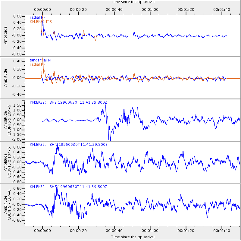
Earthquake location: Off East Coast Of Kamchatka
Earthquake latitude/longitude: 51.7/159.8
Earthquake time(UTC): 1996/06/30 (182) 11:32:35 GMT
Earthquake Depth: 33 km
Earthquake Magnitude: 5.5 MB, 5.9 MS, 6.1 UNKNOWN, 6.0 MW
Earthquake Catalog/Contributor: WHDF/NEIC
Network: KN Kyrgyz Seismic Telemetry Network
Station: EKS2 KN.EKS2
Lat/Lon: 42.66 N/73.78 E
Elevation: 1360 m
Distance: 55.9 deg
Az: 297.313 deg
Baz: 48.522 deg
Ray Param: 0.06442368
Estimated Moho Depth: 10.5 km
Estimated Crust Vp/Vs: 1.73
Assumed Crust Vp: 6.316 km/s
Estimated Crust Vs: 3.645 km/s
Estimated Crust Poisson's Ratio: 0.25
Radial Match: 92.478226 %
Radial Bump: 400
Transverse Match: 77.19685 %
Transverse Bump: 400
SOD ConfigId: 6273
Insert Time: 2010-03-08 19:49:54.209 +0000
GWidth: 2.5
Max Bumps: 400
Tol: 0.001

Signal To Noise

ChannelStoNSTALTA
KN:EKS2: :BHN:19960630T11:41:39.800Z4.95534231.8520683E-73.7375184E-8
KN:EKS2: :BHE:19960630T11:41:39.800Z8.4427331.6226424E-71.92194E-8
KN:EKS2: :BHZ:19960630T11:41:39.800Z6.35194735.064525E-77.9731855E-8
Arrivals
Ps1.3 SECOND
PpPs4.3 SECOND
PsPs/PpSs5.6 SECOND