
EKS2 KN.EKS2 - Earthquake Result Viewer
| ||||||||||||||||||
| ||||||||||||||||||
| ||||||||||||||||||
|
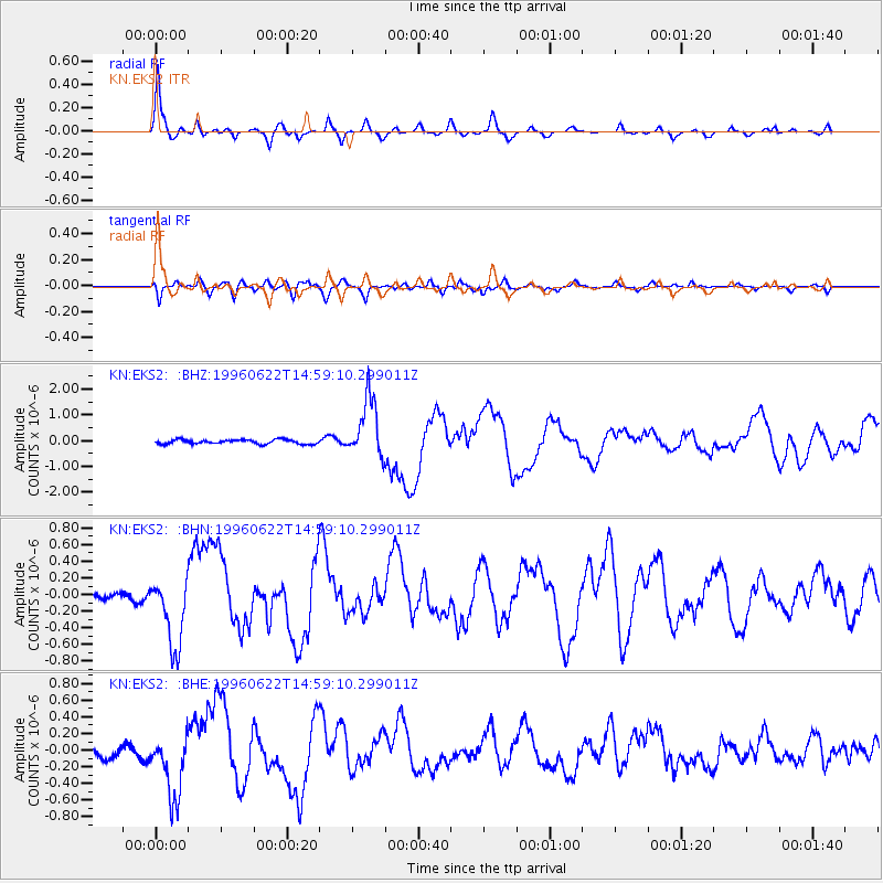
Signal To Noise
| Channel | StoN | STA | LTA |
| KN:EKS2: :BHN:19960622T14:59:10.299011Z | 7.926206 | 4.13217E-7 | 5.213301E-8 |
| KN:EKS2: :BHE:19960622T14:59:10.299011Z | 5.0393505 | 3.94429E-7 | 7.826981E-8 |
| KN:EKS2: :BHZ:19960622T14:59:10.299011Z | 13.751152 | 1.1456815E-6 | 8.3315314E-8 |
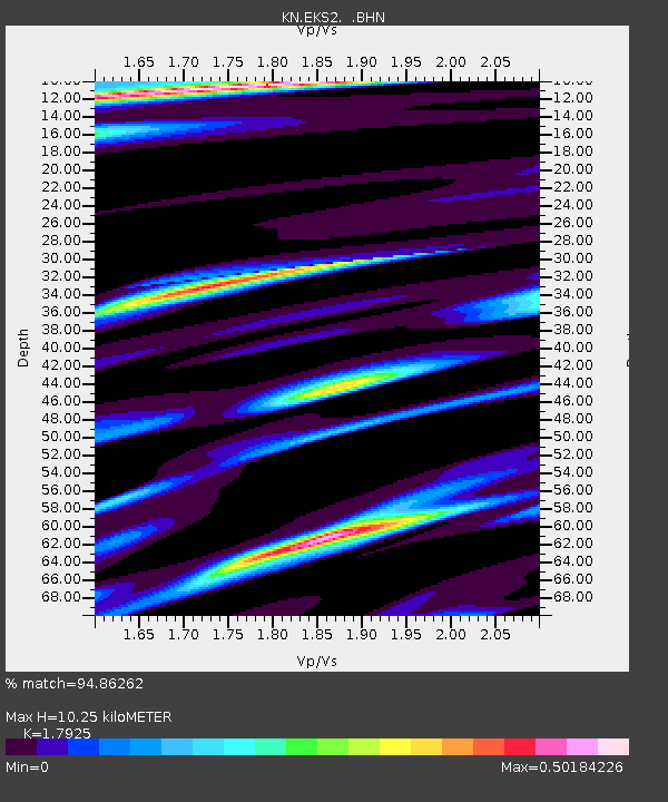
| Arrivals | |
| Ps | 1.4 SECOND |
| PpPs | 4.3 SECOND |
| PsPs/PpSs | 5.7 SECOND |

