You are here: Home > Network List > US - United States National Seismic Network Stations List
> Station MSO Missoula, Montana, USA > Earthquake Result Viewer
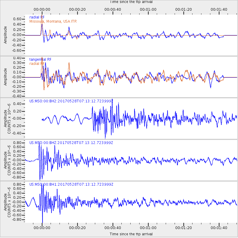
MSO Missoula, Montana, USA - Earthquake Result Viewer
*The percent match for this event was below the threshold and hence no stack was calculated.
| Earthquake location: |
Andreanof Islands, Aleutian Is. |
| Earthquake latitude/longitude: |
51.6/-175.3 |
| Earthquake time(UTC): |
2017/05/28 (148) 07:06:14 GMT |
| Earthquake Depth: |
8.0 km |
| Earthquake Magnitude: |
5.6 Ml |
| Earthquake Catalog/Contributor: |
NEIC PDE/at |
|
| Network: |
US United States National Seismic Network |
| Station: |
MSO Missoula, Montana, USA |
| Lat/Lon: |
46.83 N/113.94 W |
| Elevation: |
1264 m |
|
| Distance: |
39.3 deg |
| Az: |
71.939 deg |
| Baz: |
300.223 deg |
| Ray Param: |
$rayparam |
*The percent match for this event was below the threshold and hence was not used in the summary stack. |
|
| Radial Match: |
55.47162 % |
| Radial Bump: |
400 |
| Transverse Match: |
58.150455 % |
| Transverse Bump: |
400 |
| SOD ConfigId: |
2028011 |
| Insert Time: |
2017-06-11 07:13:17.177 +0000 |
| GWidth: |
2.5 |
| Max Bumps: |
400 |
| Tol: |
0.001 |
|
Signal To Noise
| Channel | StoN | STA | LTA |
| US:MSO:00:BHZ:20170528T07:13:12.723999Z | 6.8956814 | 3.666102E-7 | 5.3165188E-8 |
| US:MSO:00:BH1:20170528T07:13:12.723999Z | 5.680248 | 4.0060792E-7 | 7.052649E-8 |
| US:MSO:00:BH2:20170528T07:13:12.723999Z | 2.635186 | 1.7610583E-7 | 6.682862E-8 |
| Arrivals |
| Ps | |
| PpPs | |
| PsPs/PpSs | |


