EKS2 KN.EKS2 - Earthquake Result Viewer
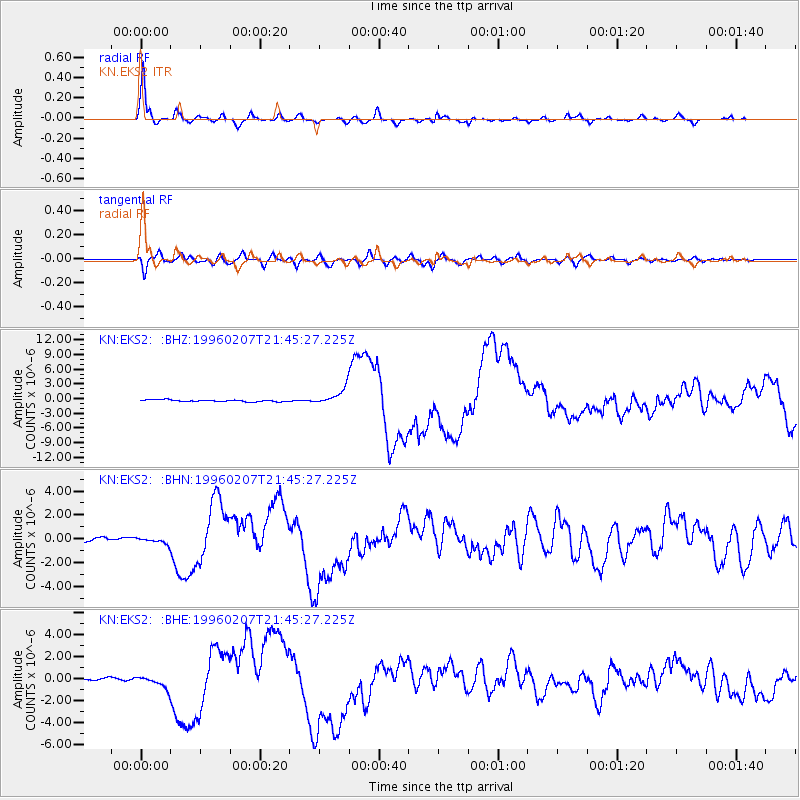
Earthquake location: Kuril Islands
Earthquake latitude/longitude: 45.3/149.9
Earthquake time(UTC): 1996/02/07 (038) 21:36:45 GMT
Earthquake Depth: 33 km
Earthquake Magnitude: 6.3 MB, 7.0 MS, 7.2 UNKNOWN, 7.1 MW
Earthquake Catalog/Contributor: WHDF/NEIC
Network: KN Kyrgyz Seismic Telemetry Network
Station: EKS2 KN.EKS2
Lat/Lon: 42.66 N/73.78 E
Elevation: 1360 m
Distance: 52.9 deg
Az: 296.115 deg
Baz: 59.184 deg
Ray Param: 0.0663995
Estimated Moho Depth: 60.25 km
Estimated Crust Vp/Vs: 1.61
Assumed Crust Vp: 6.316 km/s
Estimated Crust Vs: 3.935 km/s
Estimated Crust Poisson's Ratio: 0.18
Radial Match: 95.019875 %
Radial Bump: 371
Transverse Match: 79.50302 %
Transverse Bump: 400
SOD ConfigId: 6273
Insert Time: 2010-03-08 19:50:35.591 +0000
GWidth: 2.5
Max Bumps: 400
Tol: 0.001

Signal To Noise

ChannelStoNSTALTA
KN:EKS2: :BHN:19960207T21:45:27.225Z1.76907362.669377E-71.5089122E-7
KN:EKS2: :BHE:19960207T21:45:27.225Z2.92079765.49593E-71.8816537E-7
KN:EKS2: :BHZ:19960207T21:45:27.225Z9.0307591.657245E-61.8351115E-7
Arrivals
Ps6.1 SECOND
PpPs23 SECOND
PsPs/PpSs30 SECOND